Saanich's Plan for Uptown (and maybe the first chance to define that!)
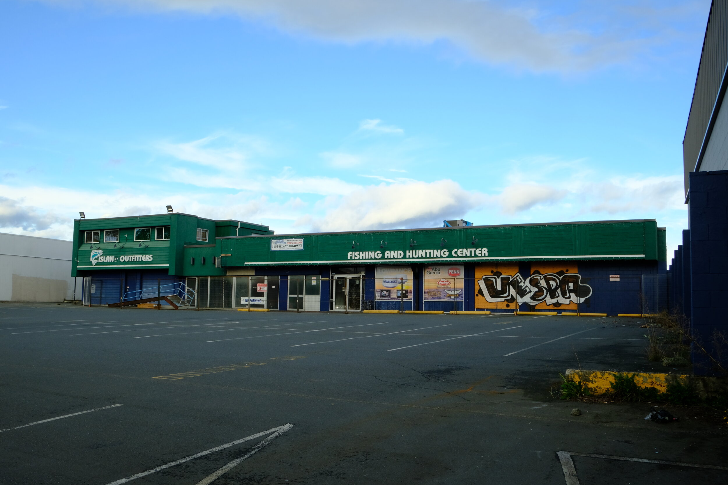
It seems like some big news out of Saanich got overshadowed by all of the things that have been swirling around us over the last many months. Somehow I completely missed the release of the Uptown-Douglas Plan by the municipality. The plan is very in-depth and encompasses the part of Saanich just to the north of Victoria along the spines of Douglas and Blanshard. What tipped me off on its existence was the news that the Aryze development company had acquired the lot currently home to the burnt out remnants of Island Outfitters along Douglas. In particular, what piqued my interest with the news of this development is that I have long considered this area to be one of the true golden opportunities for development in the city. As it is now this area is home to fairly low intensity use and of car storage for the many car dealerships in the area, but it could be a truly vibrant, engaging and productive part of the city. After hearing about the development, I began doing some reading on the Saanich site and came across their plan that made its first appearance at council just this August.
The Uptown-Douglas Plan is almost 200 pages long so there is a lot to dig into and it encompasses a very large area bordered by Burnside and Harriet to the west; Wascana and Huxley to the north; Leslie, Calumet and Rutledge to the east; and Tolmie to the South. The plan then divides this area into seven sub-areas. While the plan looks ahead and envisions change for all seven areas, there is a linkage with current uses for most of the areas with the exception of the largest one, the Douglas-Oak hub. This is also the one that the potential new development by Aryze would sit within. For this area, Saanich sees the birth of a true focused centre of the municipality, which would be an almost wholesale change from the current sea of parked cars.


I should pause and speak about this idea of a “downtown” for Saanich (that would be called Uptown…) and thread that into the context of the broader area and see how it fits, at least for me. I am a fairly strong proponent of amalgamation between Victoria and Saanich, and it would seem that the creation of a separate focused commercial and residential area would be at odds with a vibrant and growing downtown, but it isn’t. There has always been a group of naysayers that think that the latest mall or suburban development (or pandemic) will spell the end of downtown Victoria, but that doesn’t happen because the nature of Victoria’s compact downtown area is so good when it comes to the fundamentals of beauty; cultural importance; being a transportation hub; and providing high quality commercial and living space. Turning a few acres of land to the north of Victoria into a high density space (or a few hundred in the West Shore) will not take away that combination of attributes. In fact one of Victoria’s most limiting factors is space itself. At the same time, we know that metro Victoria is still growing, having crested the 400k mark last year, we can expect that it will reach the half million mark in short order. With that growth, we have some choices: continue to build out into suburbs or try and bring some more density within a smaller focused area that might be easier to serve with transit, bike lanes and high quality pedestrian environments. Victoria is going to need more high density than downtown alone can or should provide and a vibrant uptown to compliment it makes a lot of sense in this context.
Okay, so back to the plan and the Douglas-Oak Hub in particular. So if you have visited the space between Mayfair Mall and Uptown Mall on foot, you will know that you would be hard pressed to find a more hostile pedestrian environment in the city. The plan hopes to take what could be a the most hostile pedestrian environment and turn it into one of the most pedestrian friendly with a commercial high street located along Oak Street. I think that this could really work because of the malls and not despite them. The malls, at least at first, would act as sort of barbell weights on either end of the space allowing for new residential high-rise projects to be built within the current wasteland, but for them to still have very nearby active spaces to visit. With ground floor commercial added in most of the new buildings along the corridor, they may have some limited vibrant use at the outset, but as those commercial spaces extend to create a unified belt between the malls, the street itself would become the destination. The plan sees Oak Street as a slow street in the future with closures during the year to use it as a celebration space. No bike lanes indicated though which would be an improvement.

Uptown-Douglas Plan - Page 104
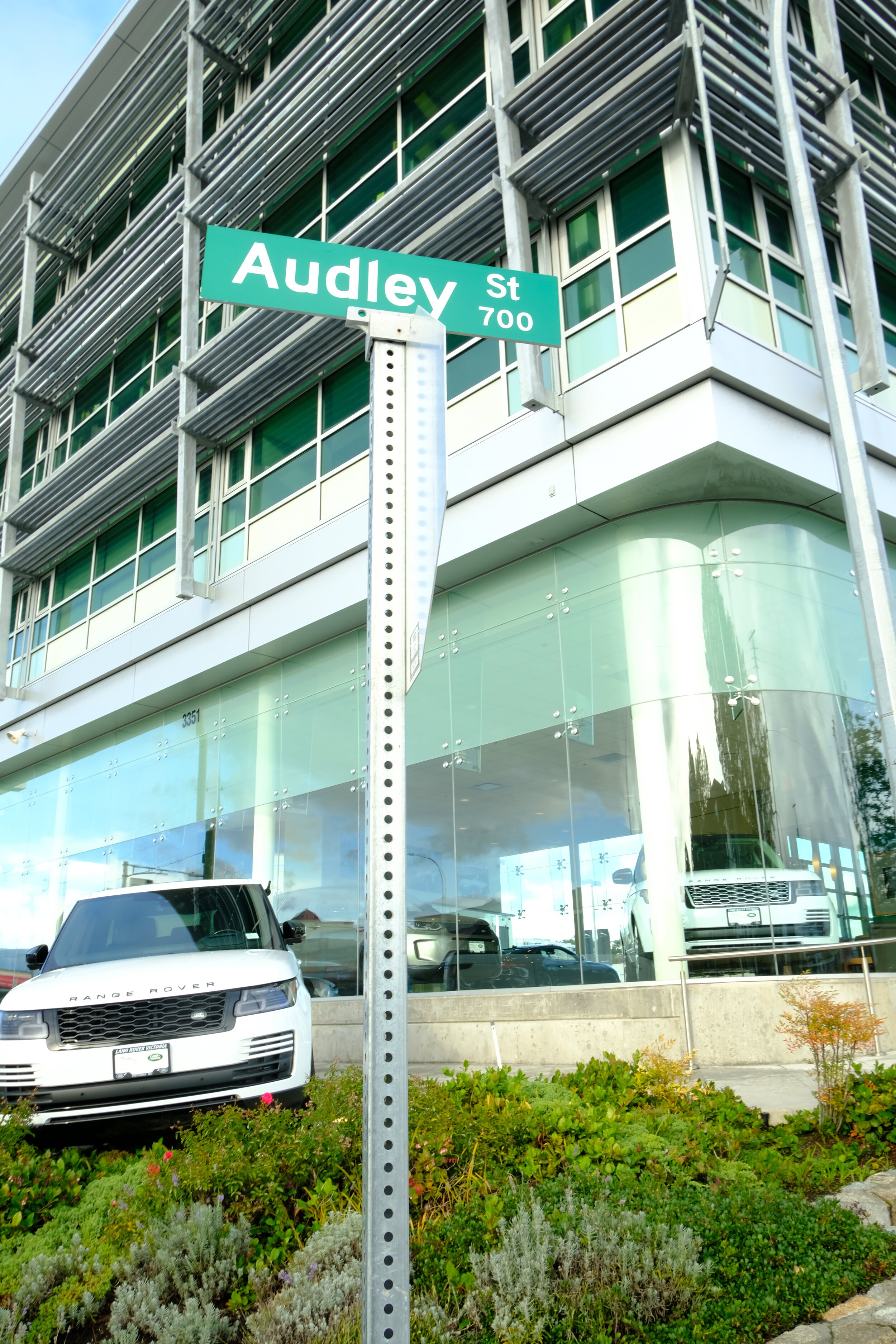
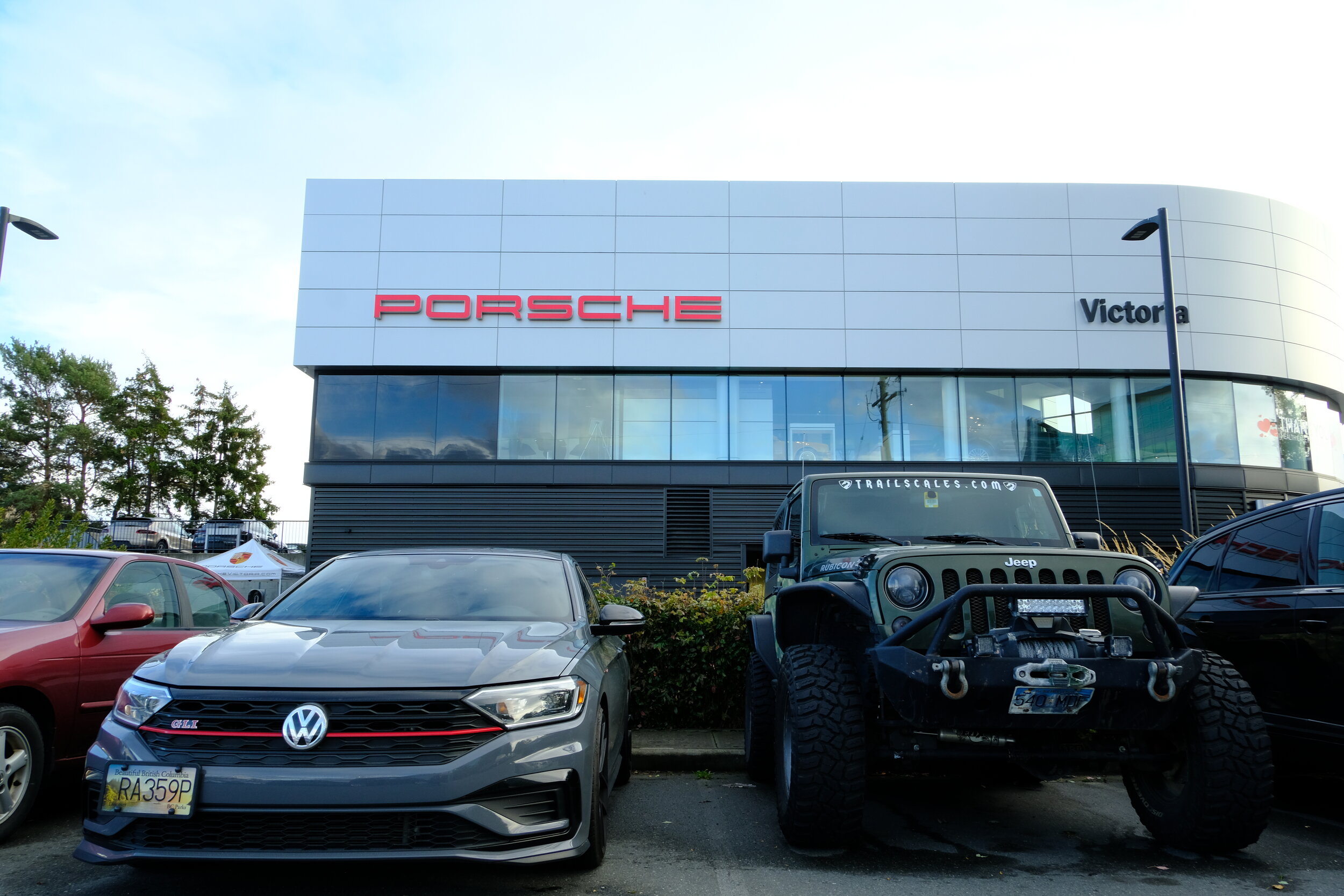
The Douglas-Oak already has two amazing advantages that will allow it to become a residential hub in advance of the commercial vitality and that is in its current connectivity to downtown Victoria. Over the last few years we have seen significant improvements to the Douglas transportation spine. While we have not seen the envisioned Douglas BRT let alone LRT come to the street, we have seen massive improvements to the transit stops and the flow of buses. As this new neighbourhood begins to grow, good transit will ensure fast, efficient connectivity with downtown, something that most of the city is still missing out on. The second transportation benefit of the area is the easy access to the Galloping Goose Trail to downtown which provides a seamless, safe bike corridor into the centre. It is such a juxtaposition currently that this car dominated area that feels very hostile to ride is just a few metres east of this great bike highway makes up. Plus the plan has some things up its sleeve to help this along. The plan builds on these acknowledged transportation benefits of the area, in particular the ‘Goose’ connection with the creation of a new east-west multi-modal pathway along Audley Street. I am sure that few Victorians have ever heard of Audley Street unless you happen to drive a Porsche, Jaguar or Land Rover. Audley is situated just to the south of the Land Rover dealership on Douglas and is just a half block long, though you can walk through to Oak Street across private property where it will one day connect. The Douglas-Uptown plan envisions this as a pedestrian and bike focused commercial street between Douglas and Blanshard that would at its western end connect with the Galloping Goose Trail. To build further opportunities both for connectivity and also commercial space, the plan sees the creation of a new north-south cross street across Audley between Oak and Douglas ,which would operate as a low volume traffic street, but could accommodate bikes and pedestrians as well. At its north end, this alley would connect with Short Street, which I will discuss later. When I think about this space built out I can’t help but envision a modern combination of Metrotown and Blood Alley in Gastown (Vancouver) and if that mix could be pulled off this could be a significant draw for the rest of the city as well.
Enjoying Sidewalking Victoria? Buy a sticker from the Sidewalk Store!
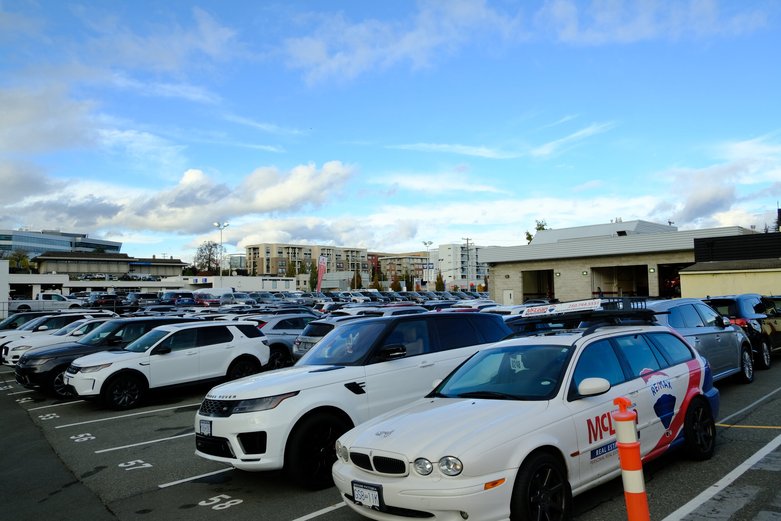
So everything sounds easy and great right? Well, it is not as easy as all that and there is significant resistance to this plan already coalescing. After discovering the plan, I went back and looked at the conversation that had occurred on Vibrant Victoria a couple of months ago to see what the opinion on their was of it and it was not as positive as I had thought when I had read it. You can read the thread here. While there are a few posters on there defending the plan, it seems like many are very concerned about losing the land as it is used right now. There is validity to the basis of this concern, as they focus on the loss of light industrial land. That said a quick walk through, at least the space that is within the Douglas-Oak hub and you can quickly dispel any concern. The land here that is actually being used for light industrial is minimal and is instead mostly taken up by large swathes of car sales storage. The implementation of this plan will take place over a long period of time and hopefully focus on those large car lots first rather than the lots that are actually taking advantage of the light industrial zoning. The change will be similar to what we are seeing now in Harris Green, there will be a very slow transition. Remember the Harris Green plan was completed in the mid 1990’s and we are only now seeing the slow dismantling of the car lots that have lived there for decades. This will be the same for the Douglas-Oak hub. Which brings us full circle to the first spark, the new development by Aryze.
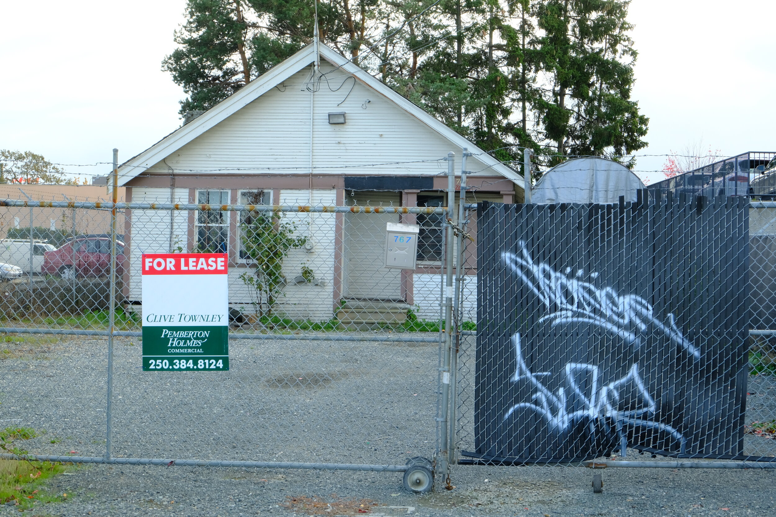
So it is early days and as it stand the first new development on Douglas where Island Outfitters used to live has not been approved. That said, Sidewalking Victoria was able to confirm that the initial plans there would be for a mixed use development that would adhere to the new Douglas-Uptown Plan so I am hopeful that this first spark could really ignite something larger. This development has the potential to be a beacon for this new neighbourhood and it is uniquely located to do that. Right outside this site is one of the brand new bus stops and it is only a lot away from Audley Street and that future connection to the Goose. I am hoping that Aryze can take advantage of the lack of density limits and height limits that allow on this lot up to 18 storeys. I am hoping that we can see a nice wide sidewalk that goes right up to a big commercial/retail window.

The Short Street residential pocket currently swimming in a sea of cars.
I should point out, as I said I would, that this is not the first residential development in the area. Short Street which is an L-shaped street that leads off the north east edge of Oak Street just past the Nissan dealership has quite a collection of dense residential. Up till now it has seemed a little out of place. It will be great when it is the low density residential that looks out of place in comparison to the rest of the neighbourhood!
If you have seen the plan, I would love to know your thought on it and your opinion of the future possibilities for the area. Please leave a comment below!