An Eastern Newfoundland Road Trip
To skirr, is to search about and was a term originally used by the fishermen of Newfoundland, at least according to the Dictionary of Newfoundland English. Looking at the usage descriptors though, I would say it is a pretty accurate description of my recent trip to Canada’s easternmost province. I will say that I started this as a single article, but I have now realised that it contains just way too much adventure. So I have now split it into a two-part series; the second one, on St. John’s will follow along in a couple of days.
Despite my partner having been born in Newfoundland and having extensive family there, I had never visited with her. Before going on the trip to Cuba last year, we had tried to plan a trip to Newfoundland, but as the travel restrictions had mostly been removed across Canada, there was a huge rush of people trying to get back home and there were no rental cars to be had. We really wanted to have a car for our trip so we could visit a larger area of the island. This year, with more cars being available, we were able to book one and make plans with my partner’s family. With family in St. John’s, we spent about half the trip there and another half travelling around. This article is focused on three of the four central parts of our trip including: Northwest Avalon Peninsula, Bonavista Peninsula, and the Irish Loop. As I said before, an article on St. John’s is in the works. I hope that I can give you a taste of what it is like in Newfoundland, honestly though, I thought I had a decent idea of what it would be like and I was way off, it was so much better!

Northwest Avalon Peninsula
The Avalon Peninsula is a pretty misnamed piece of geography. It refers to the entire landmass that St. John’s sits on and and all the way west to Come by Chance. It has at least four or five very large peninsulas coming off of it depending on how you look at it. The area that I am talking about when I say the Northwest Avalon Peninsula is the one that starts at the bottom at Holyrood and continues up and around to Dildo.
We left St. John’s on our third day in the province and headed off to the west. Our first stop was the small seaside town of Brigus. Brigus is a beautiful little historic town with many of the buildings having been fixed up and there is even a National Historic site called Hawthorne Cottage there. As we had a lot of ground to cover between there and the town of Dildo, where we were staying that night, we didn’t go in Hawthorne Cottage, it did look like a beautifully restored building. What we did have time for was lunch and we went to the first place we saw, the North Street Cafe. I am really glad we did as it was a great place. I had a traditional lunch of fishcakes and toutons with molasses which was my first really traditional Newfoundland meal. We did a loop walk around the village, it is truly picturesque and you can understand why it is a draw for tourists. There is also apparently an amazing blueberry festival.
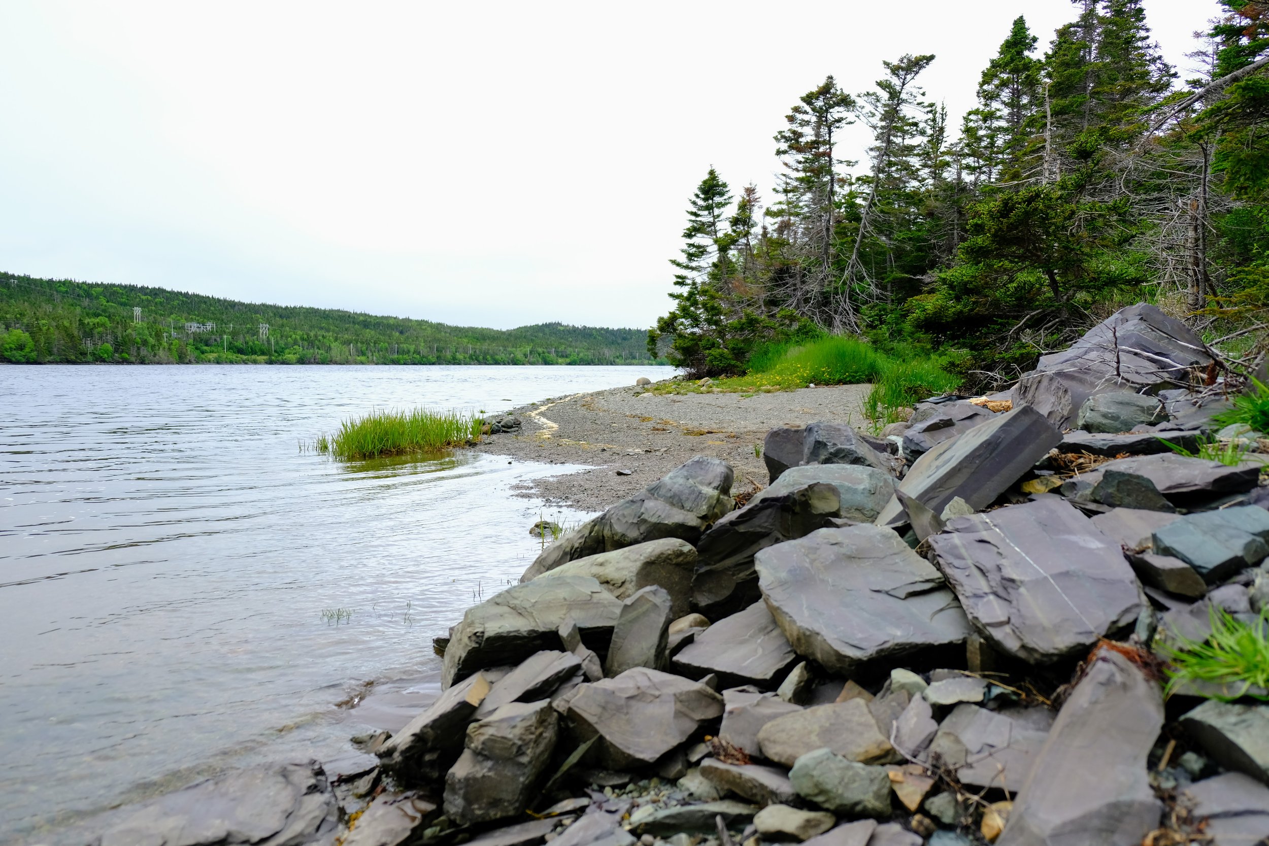
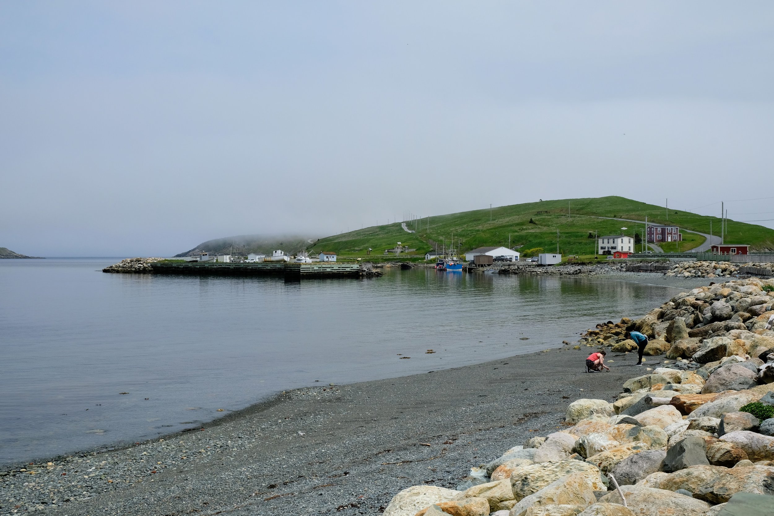
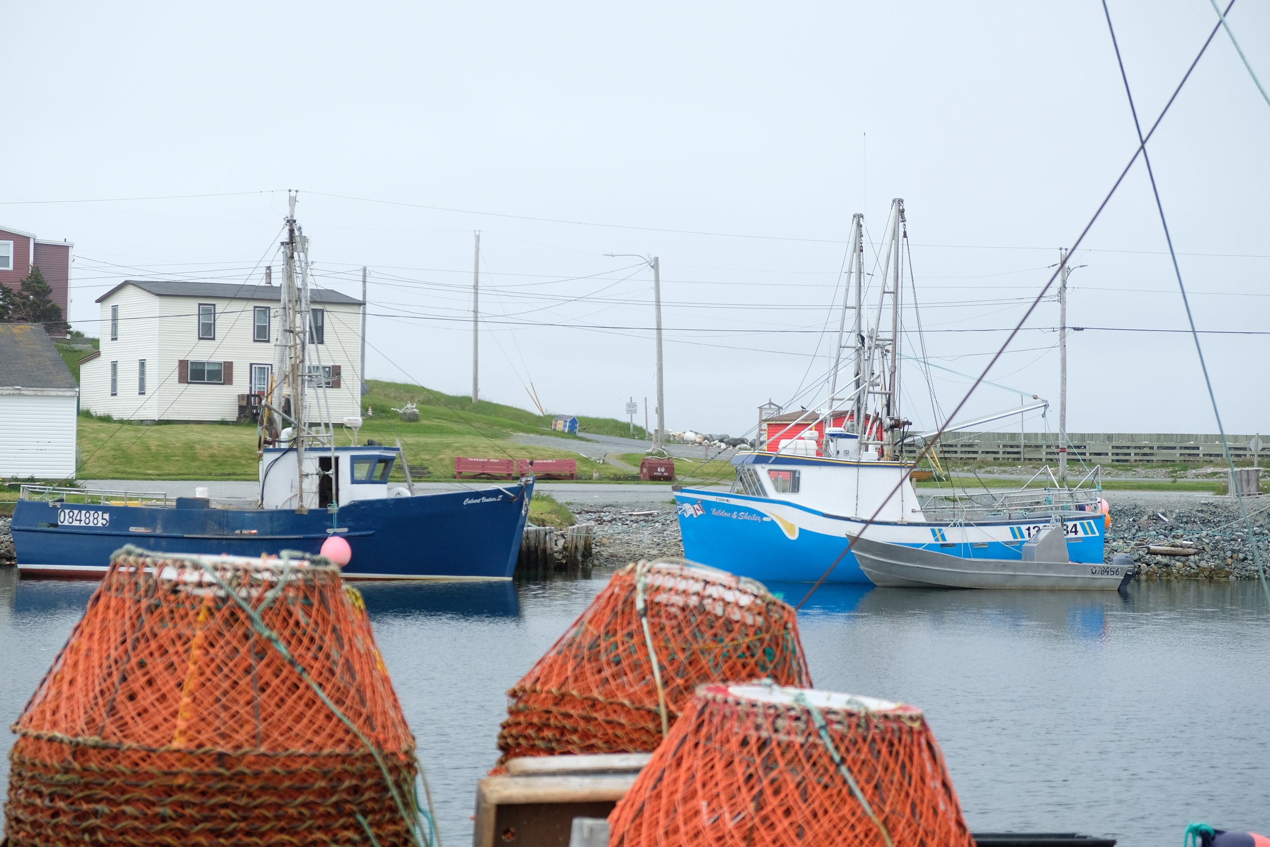
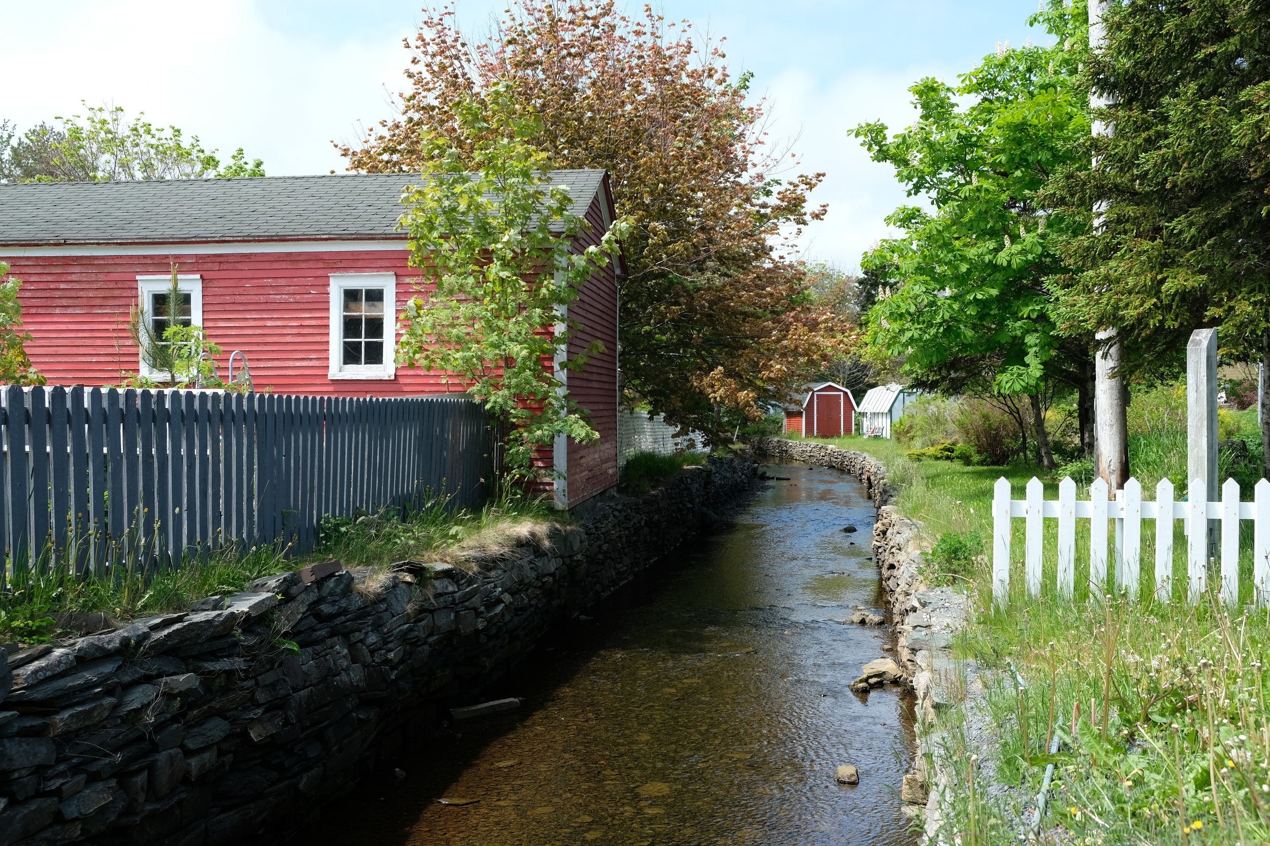
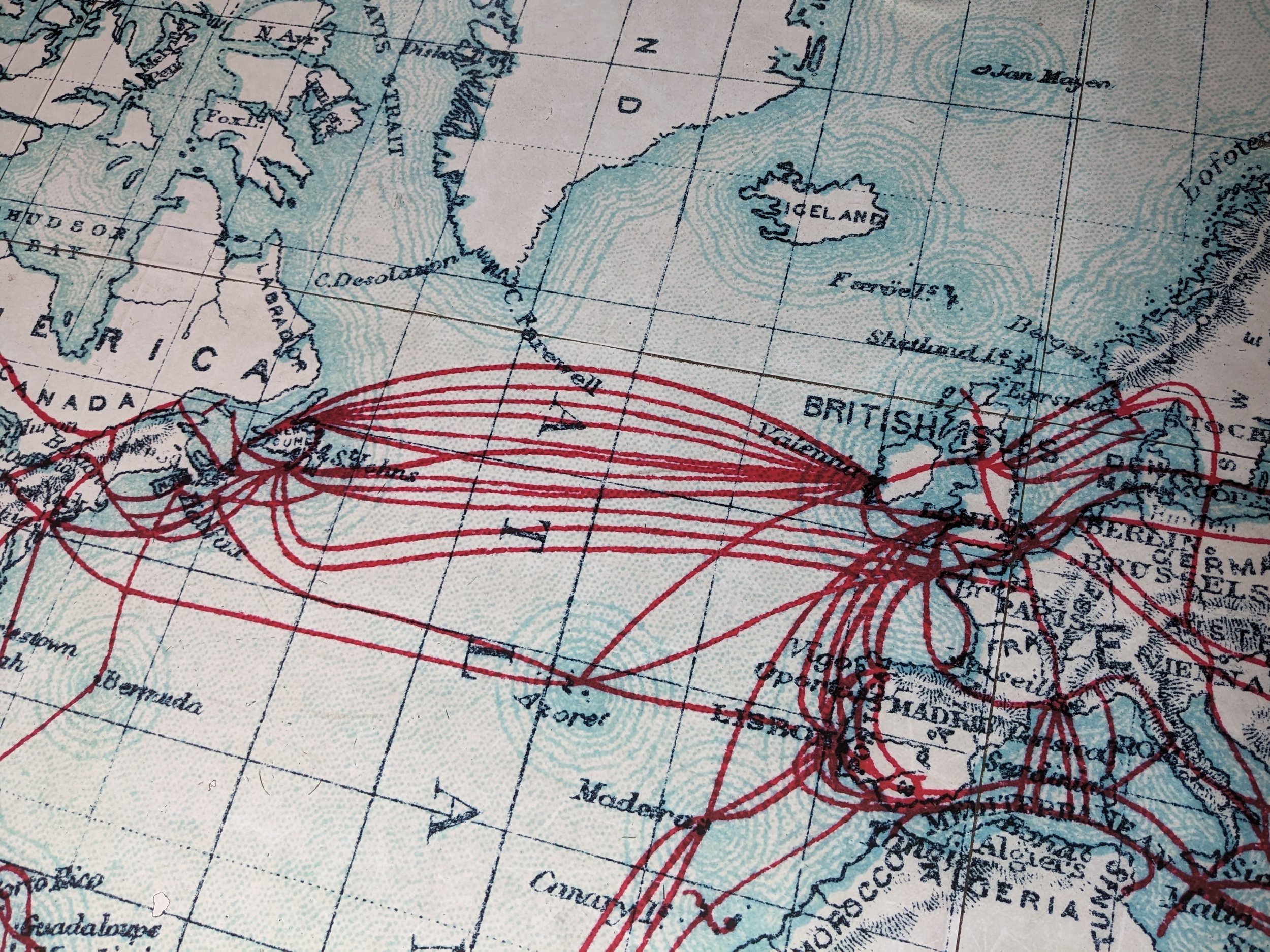
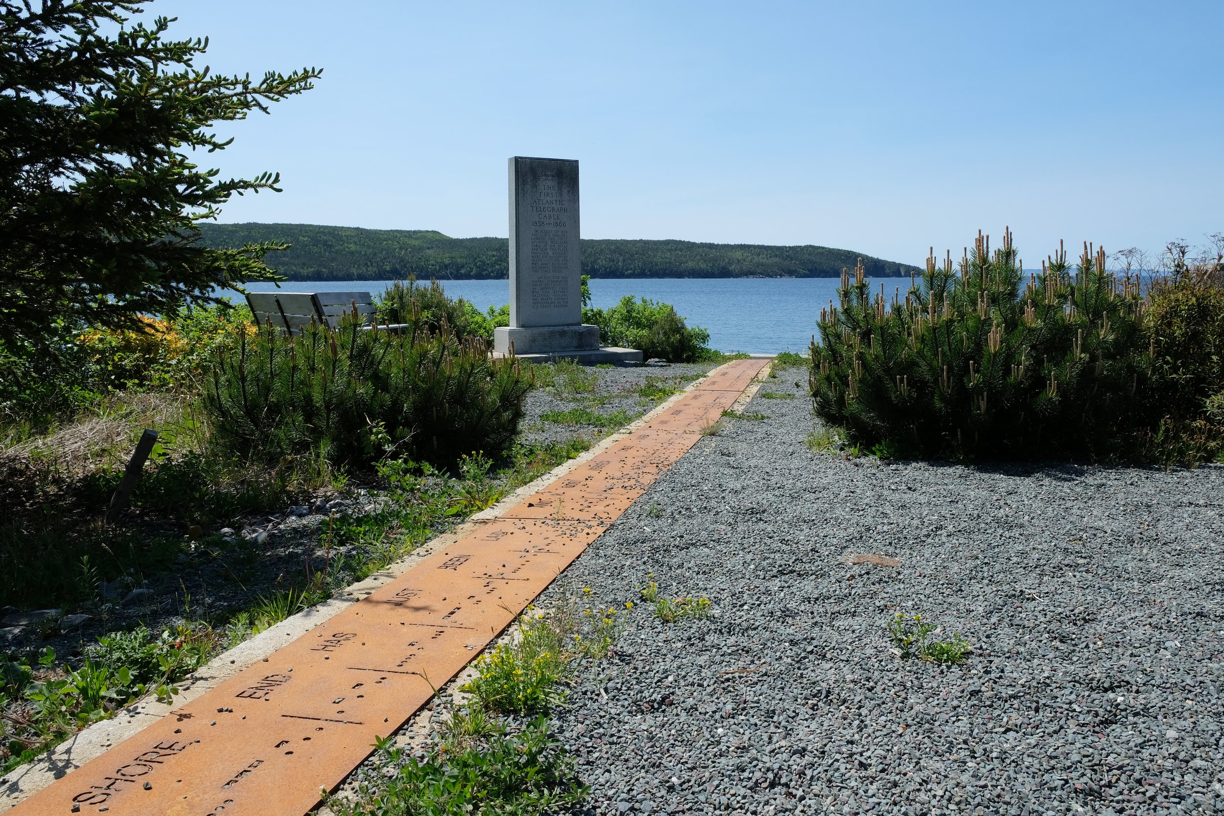
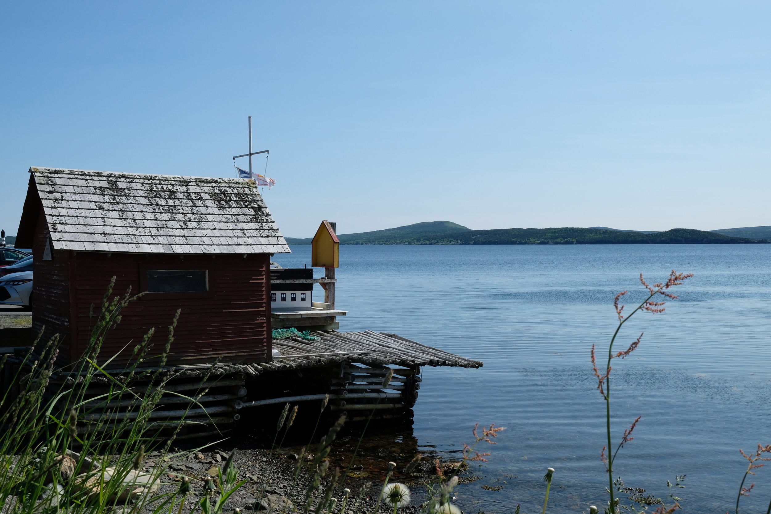
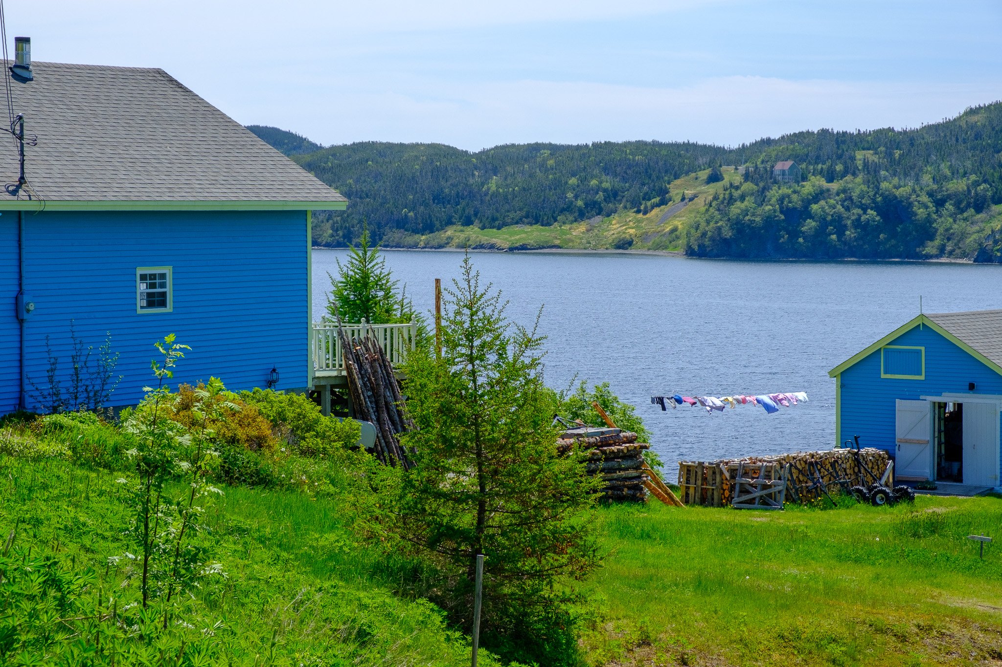
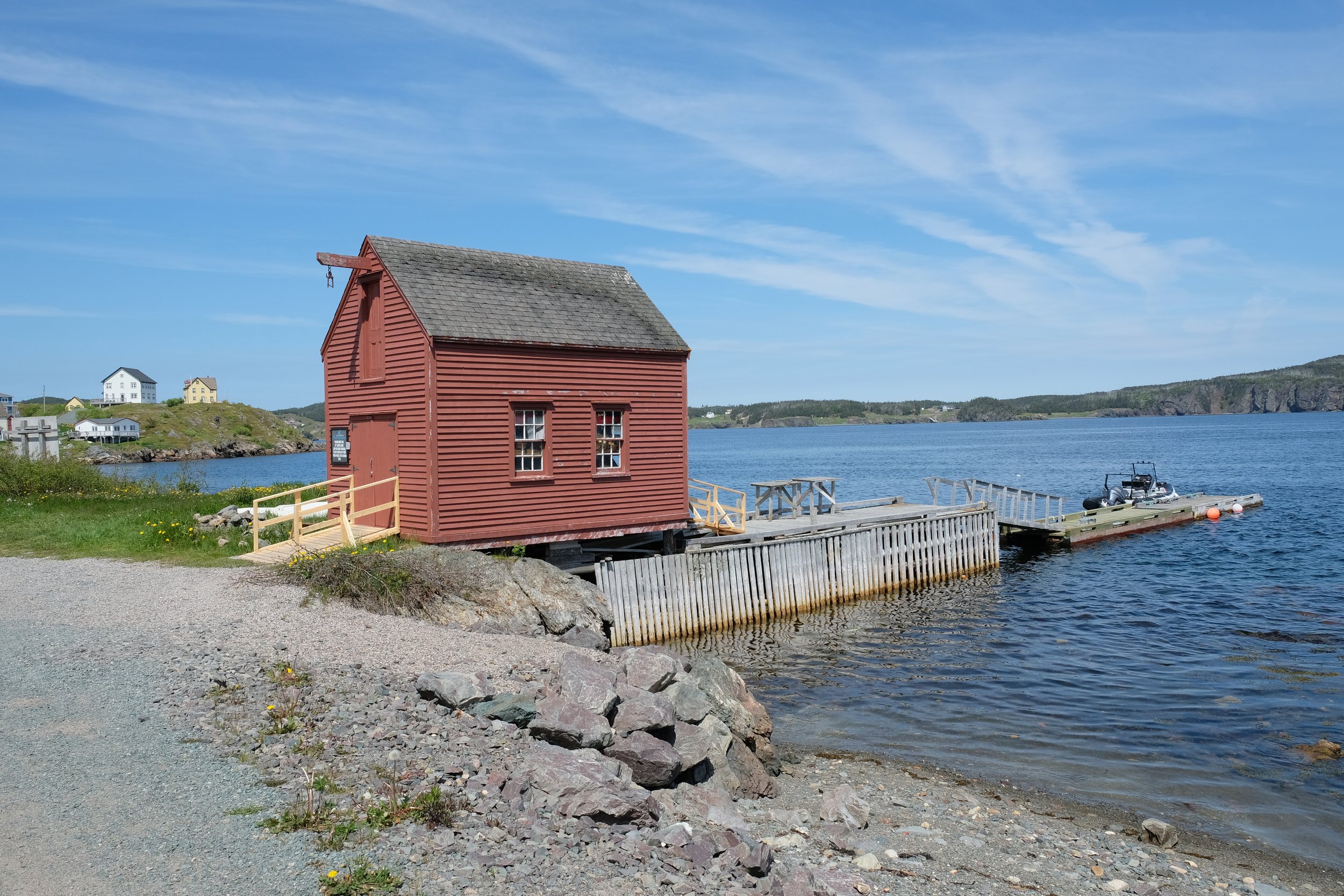
We kept driving up the peninsula, pausing for the occasional photo as far as Carbonear and then cut eastward across the peninsula (the smaller one we were on…) to Heart’s Content. This was another beautiful little town. There seemed to be less trees around the town than Brigus had. The main reason for the stop here was the Heart’s Content Cable Station, Provincial Historic Site. This was the site of where the very first oceanic cable connecting Europe to North America came ashore. There is a great little museum here that talks about all that was done to create the cable and you can actually see a lot of the station as it would have been while still in operation. I couldn’t believe that the first cable was laid in the 1850s and that the station remained in service until the 1960s. After a few more photos around the town, we left and headed for dinner and our accommodation in Dildo. We had dinner at the well-known Dildo Brewing Company and stayed at a place just past it.
This first day had been a little overwhelming in all that we did. The drive and the places we saw were far more beautiful and vibrant than I had expected. I have included some pictures from this first area below.
Bonavista Peninsula
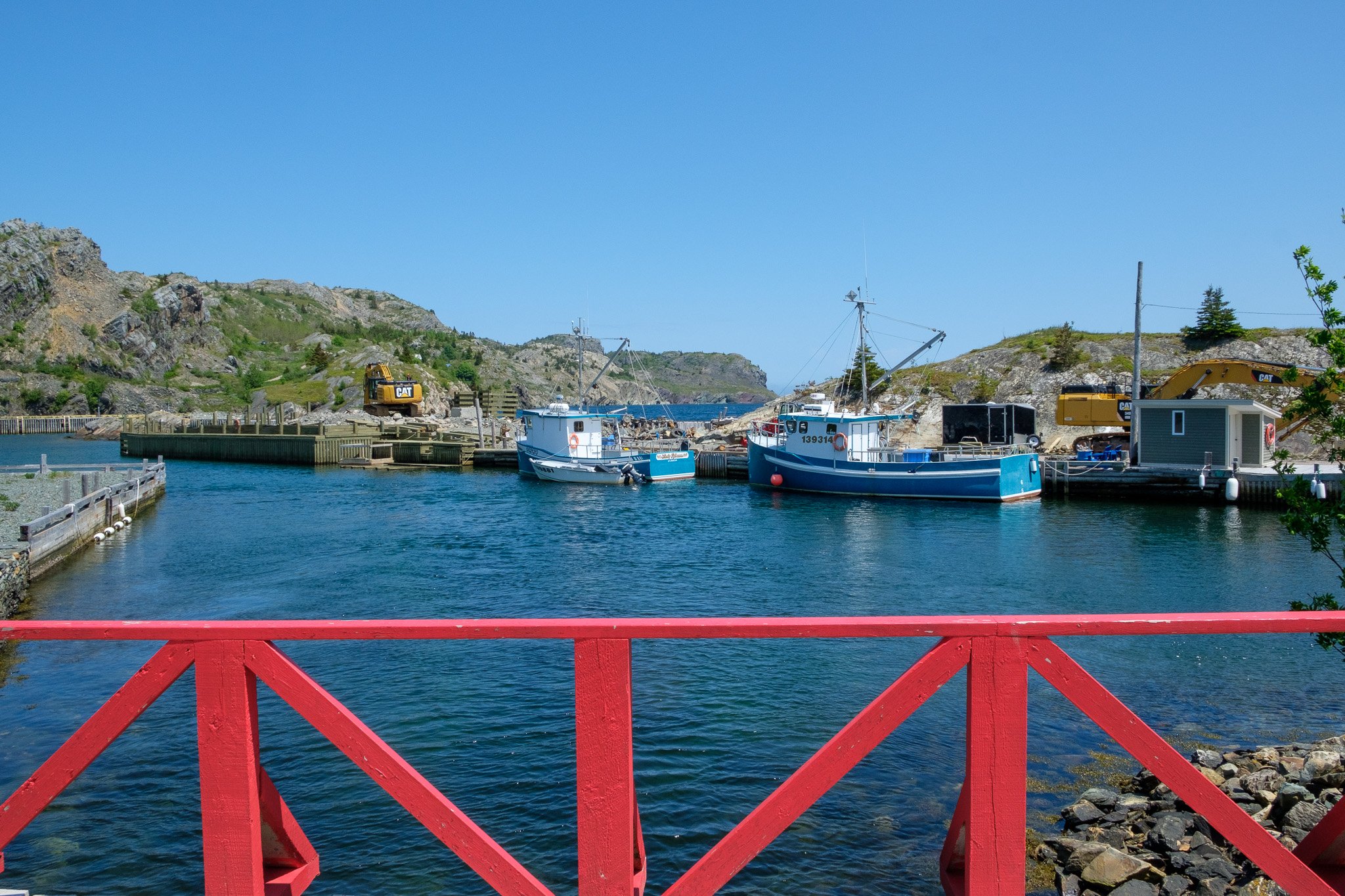
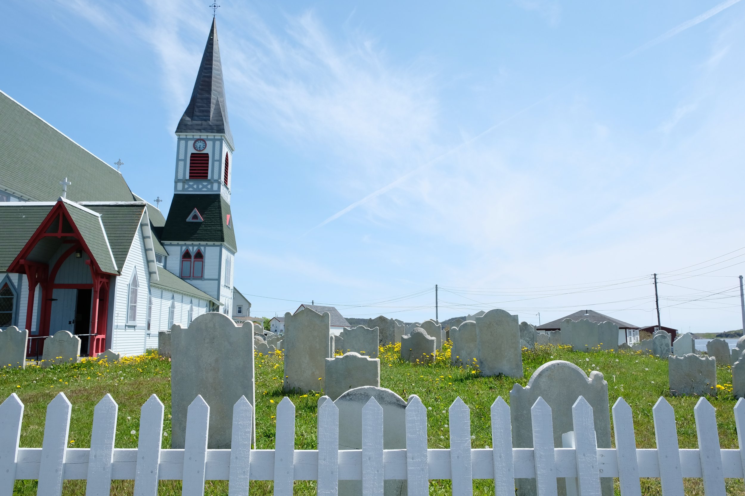
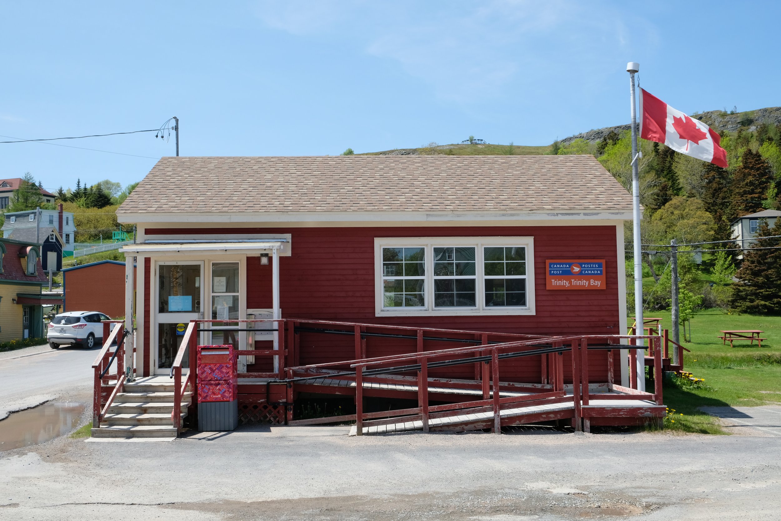
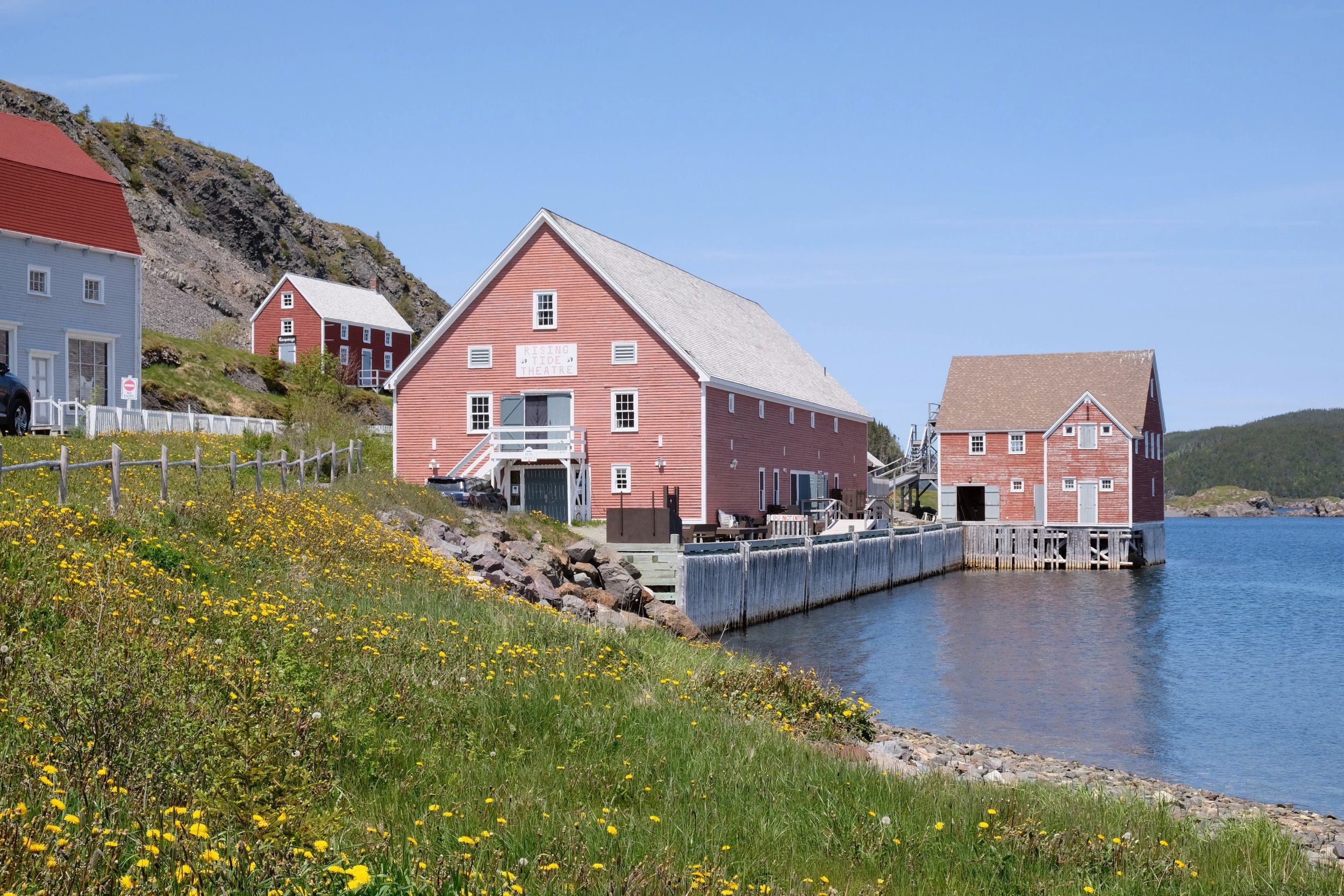
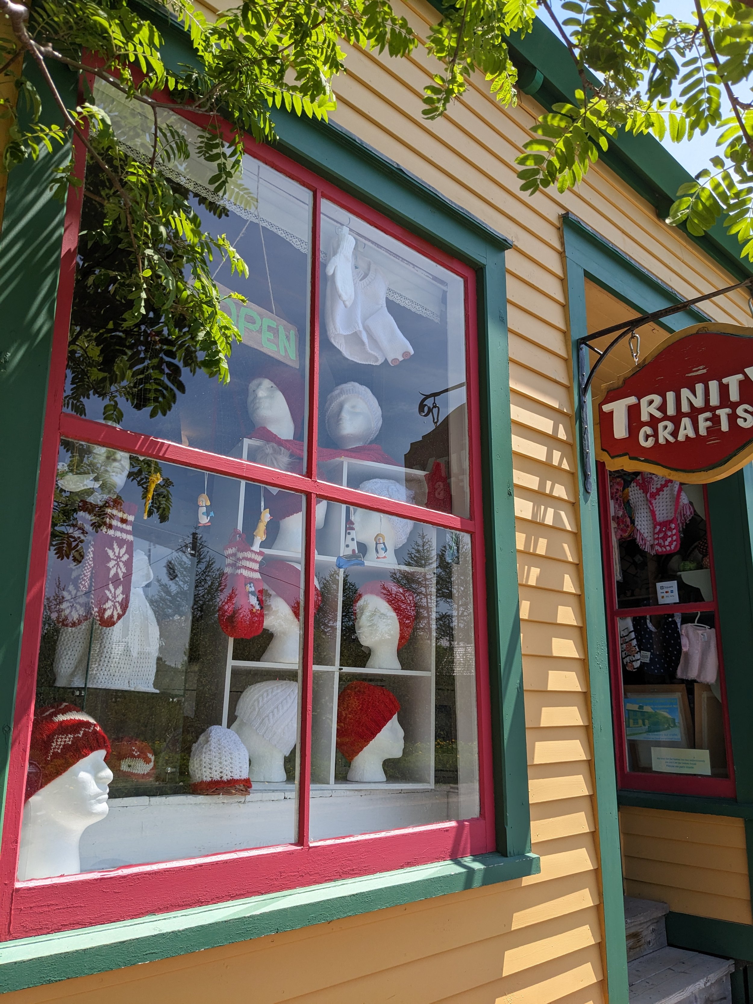
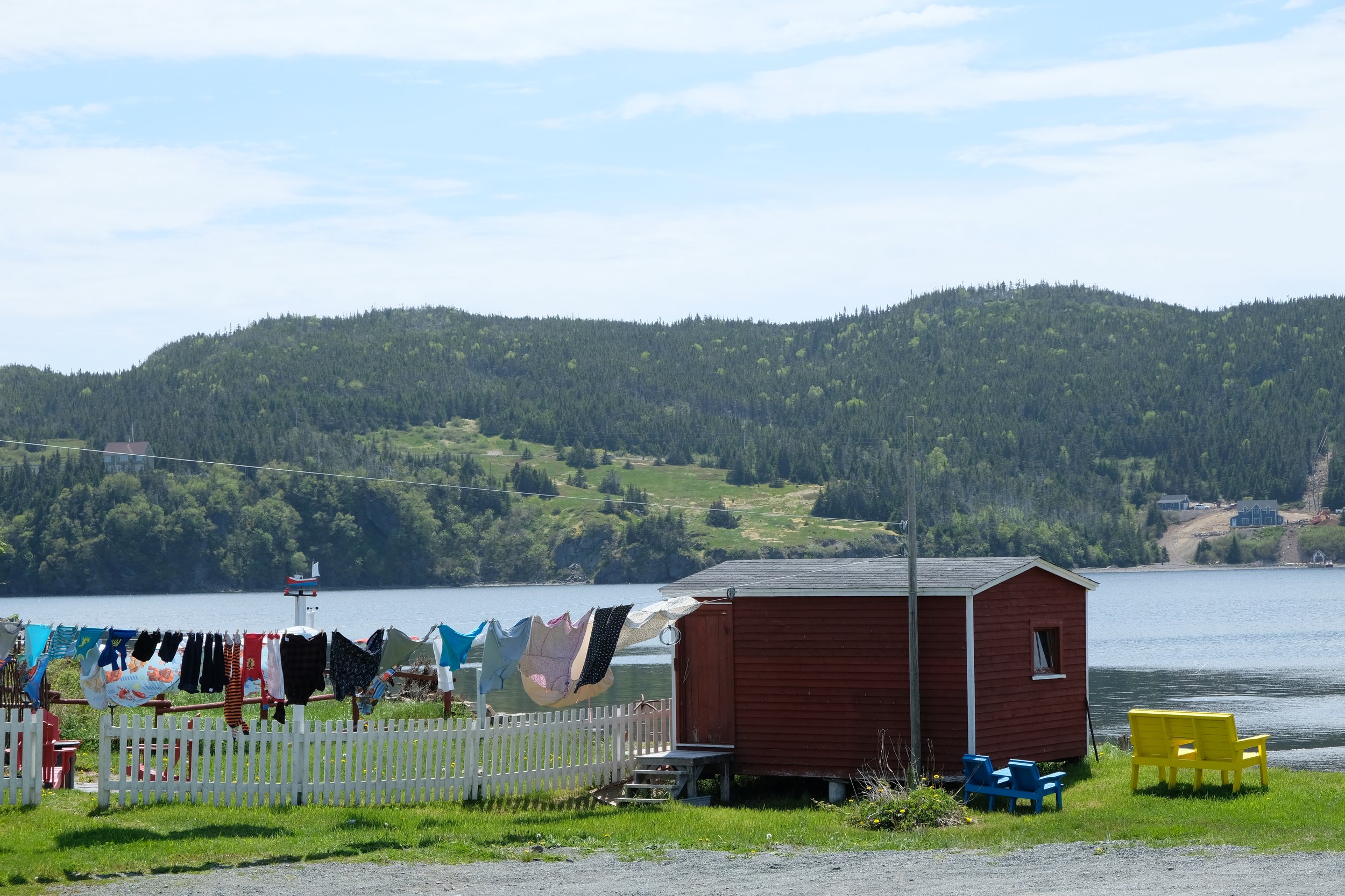
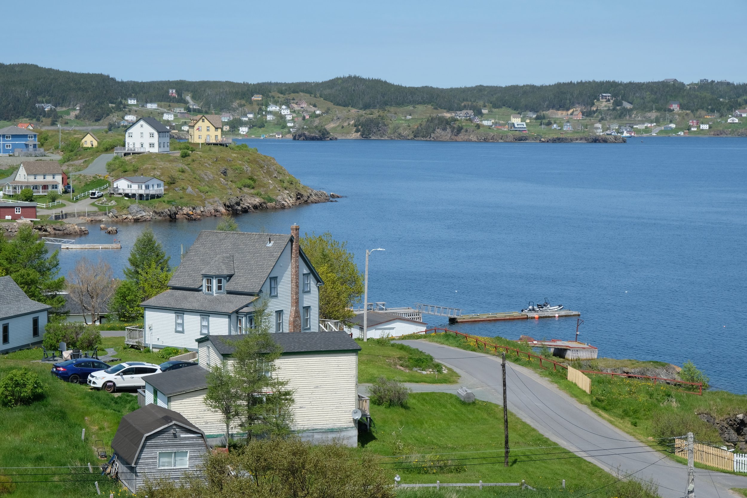
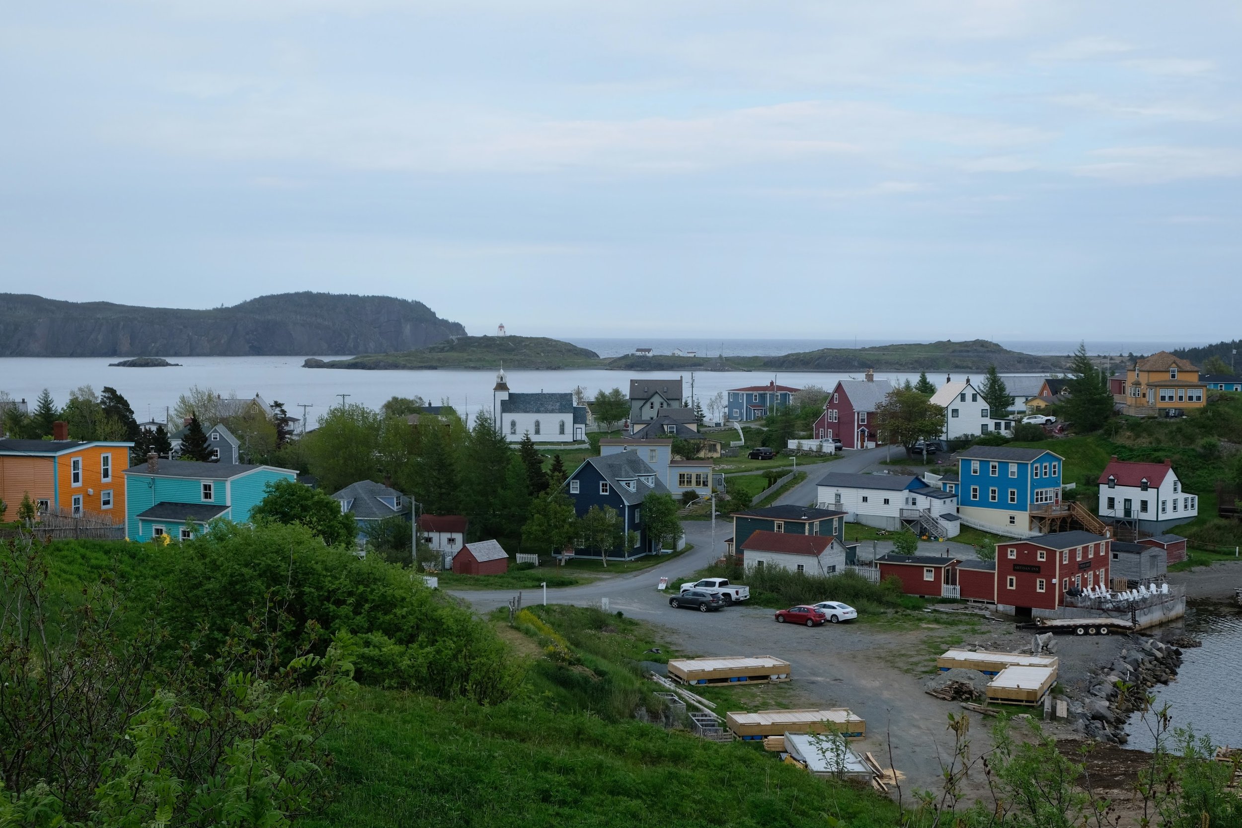
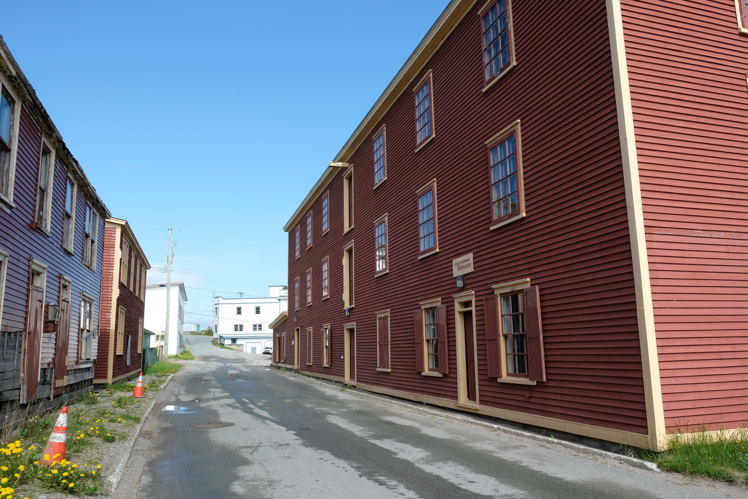
The second area we were exploring was the Bonavista Peninsula, where we spent three days. Our home base for our explorations was Trinity on the east coast of the peninsula, one of the oldest colonial towns in eastern North America. Given Trinity’s relative proximity to St. John’s, it should be on the list of must-see places in Newfoundland if you are going for more than just a couple of days.
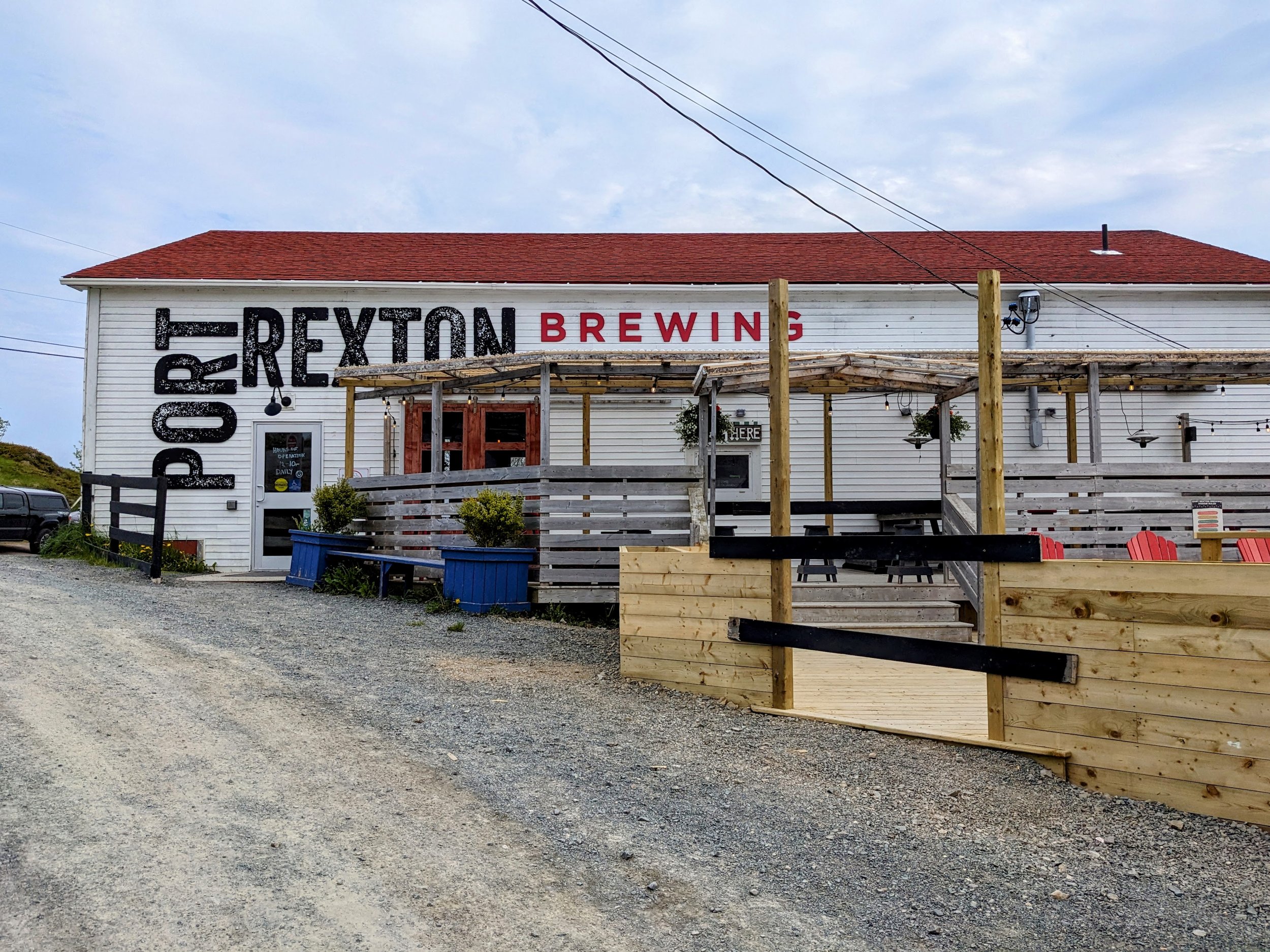
When we first arrived in Trinity, we did a little walking about and exploring of the town, while our room was being made up at the local Rosewood Inn. The whole town is set-up kind of like a big museum with multiple historic buildings you can go into, though you did need to pay an entrance fee for them. There are two options for the entrance fees, one through the provincial Visitors Centre and one through the historical society and they give you access to different buildings. It seemed like an odd way to do it. We opted for the smaller list of buildings through the visitors centre as it felt like we might be too rushed otherwise. Checking out some of the historic buildings and just wandering around this beautiful little town was quite magical. Trinity reminded a little of the historic part of Port Townsend in Washington, where the actual village seems to have been mostly handed over to tourists and not really lived in by many locals, though I could be wrong in that. Contrary to many of the other seaside towns nearby, Trinity was not really a fishing port and instead was more of a commercial trading spot, though it did get its start in the 1500’s as a seasonal fishing outpost for the British. Trinity should definitely be on your places to see if you visit Newfoundland, though I expect it would be, given the tour buses we saw roll into town. For dinner our first night, we went to the next town north, Port Rexton and ate (and had a drink) at the excellent Port Rexton Brewing Co. I am fairly certain this was my favourite of the four craft breweries that we tried in Newfoundland.
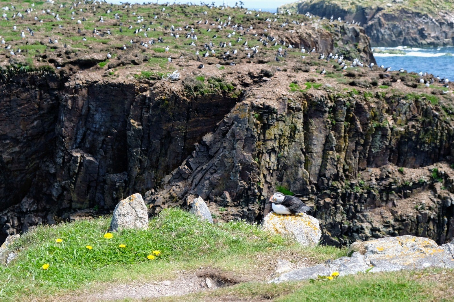
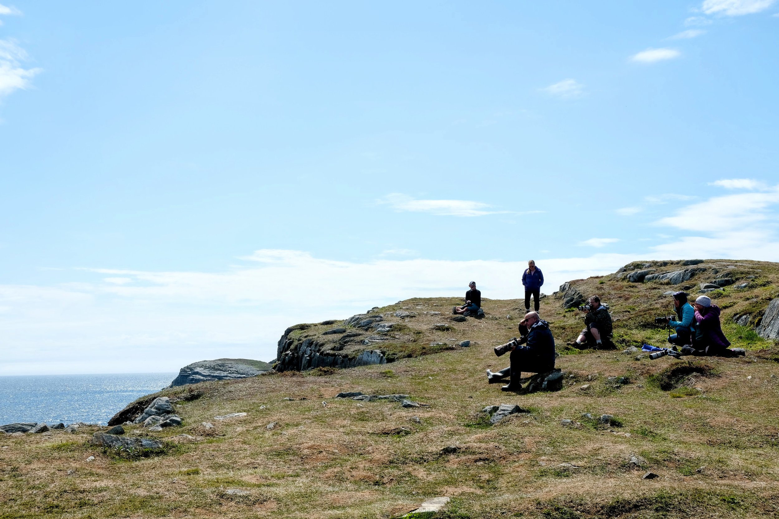
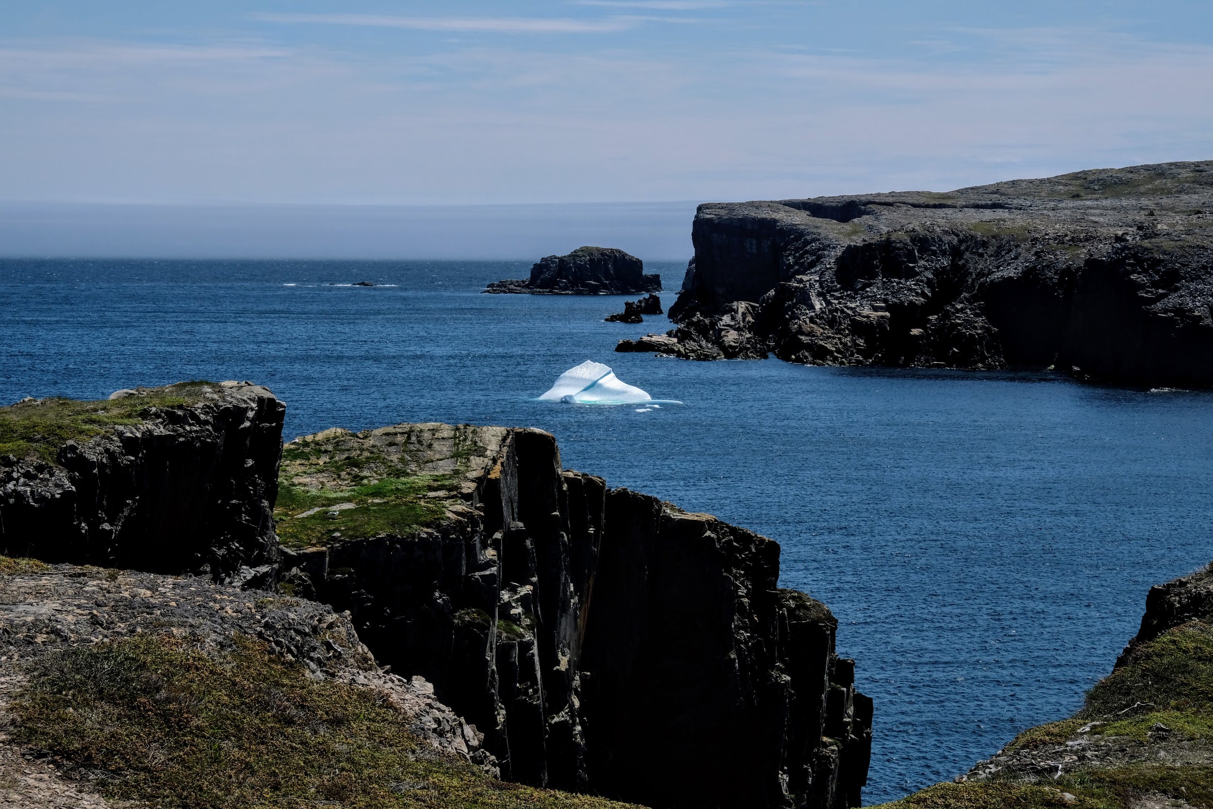
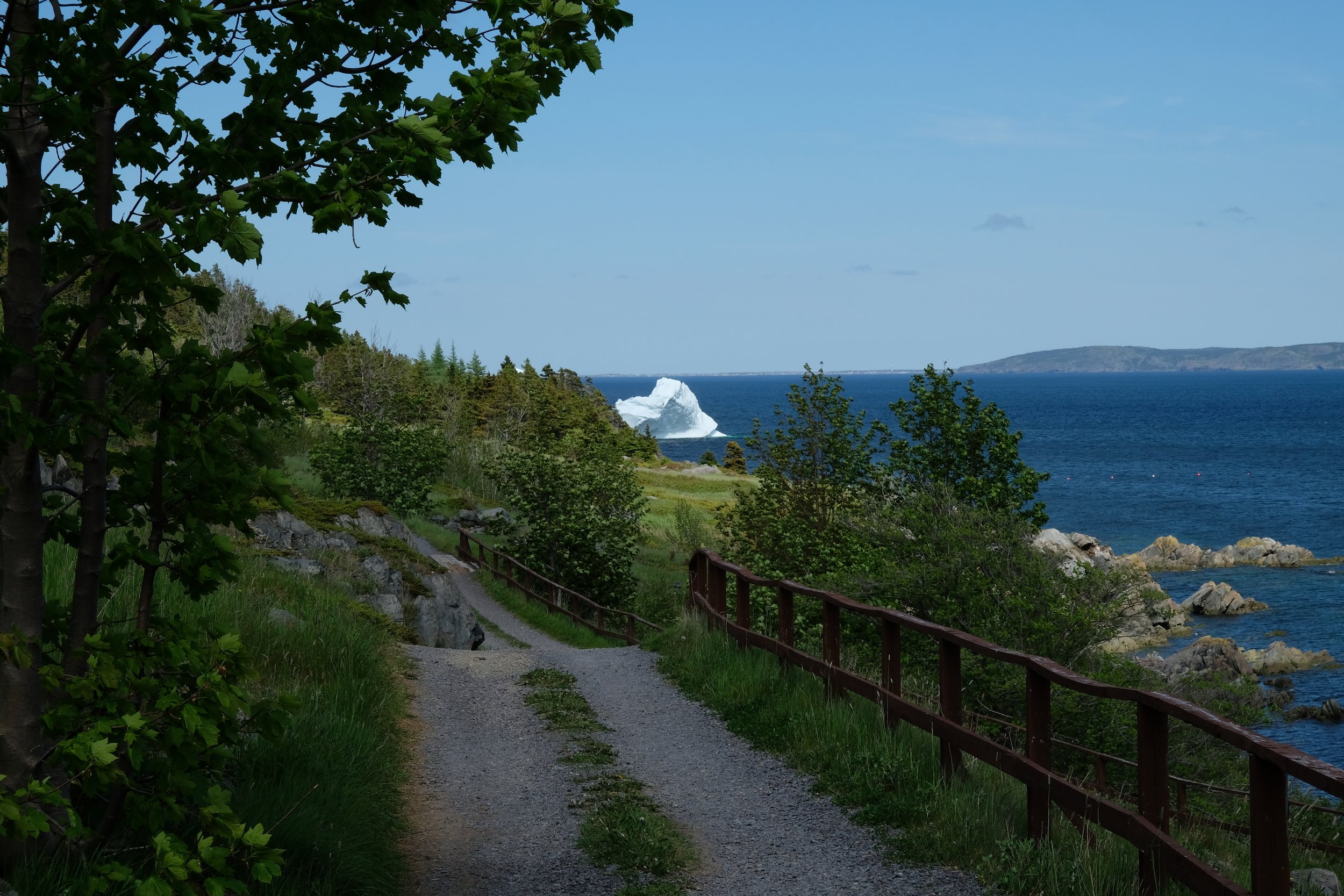
Our next destination was to see the puffins in Elliston which is a little ways north of Trinity. As I have never been anywhere like Newfoundland, I had never seen a puffin in real life and didn’t really know that we would get to see much. We parked in a parking lot surrounded by root cellars (Elliston is the root cellar capital of the world) and started walking out on this barren, rocky point that jutted out into the sea. As we walked out, we saw our first iceberg in the distance (I had never seen an iceberg before either). While you walk out on the point you smell the puffins before you see them though it isn’t entirely overpowering. You skirt around a large rocky outcropping and then you are first confronted by a large group of zoom lens toting bird watchers before noticing the large rocky island just off the point covered in thousands of puffins. Even better was that as we looked around we noticed that a few of puffins had decided to get closer to these strange humans and so we could actually see them up close. I will admit it was a little unnerving being out on top of this giant rock with waves crashing at the bottom with my three year old, but my partner and I took turns holding on to him while the other person got a good look at the puffins. It was a really incredible experience.
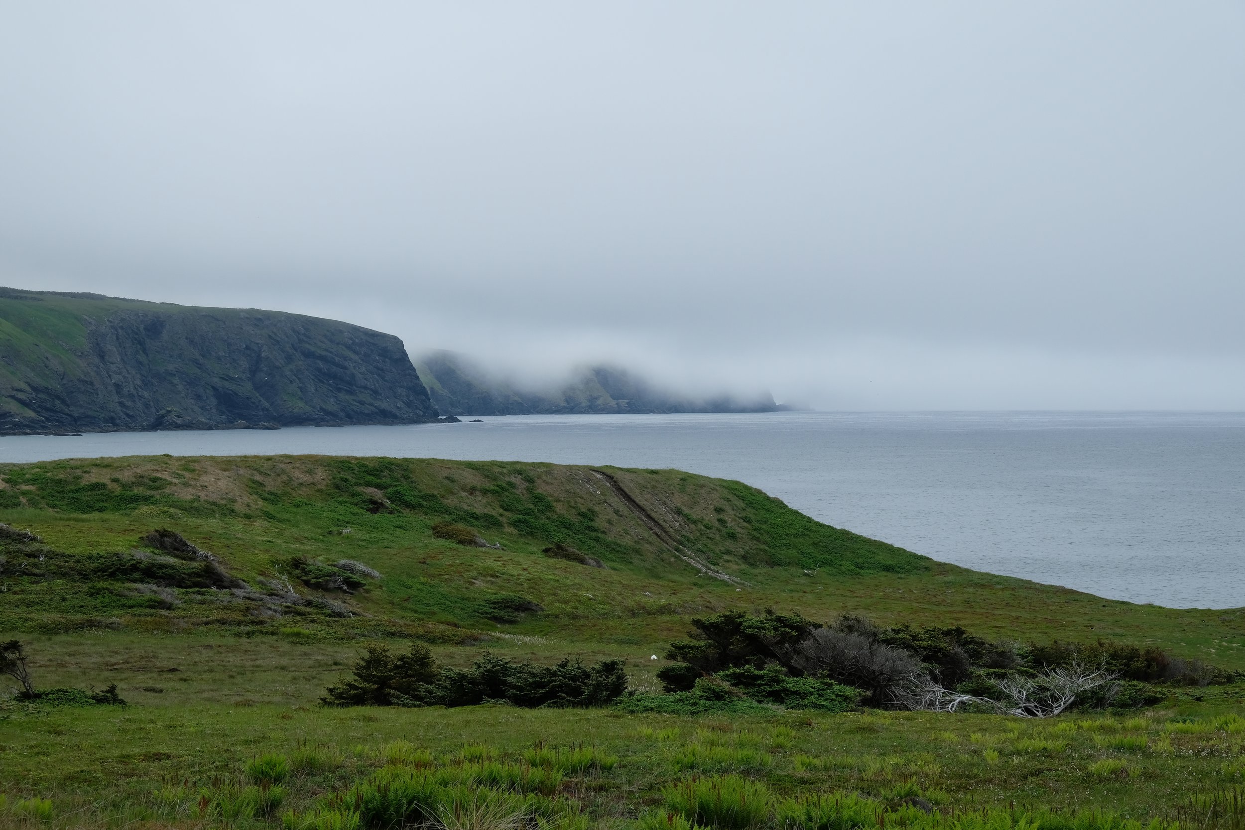
The night previous we had been told of a nice hike to the north of Elliston at Spillars Cove by a couple at the Port Rexton Brewery, and after some research it seemed like a great option for us. With the little guy tucked into a hiking backpack we went out to explore the cove. Not only was the hike nice but the cove itself was absolutely breathtaking with steep cliffs, sea stacks and more icebergs. You couldn’t help but have your breath taken away by the visual input of the place. If you want to go on a longer hike there are options of following trails all the way down the east side of the peninsula and I would love to do that on another visit for sure. The Bonavista Peninsula was definitely a highlight for me of the trip. We did a lot more than I will go into detail about, such as the town of Bonavista itself, King’s Cove and Port Union. And there were likely another 50 places that we could have visited but didn’t due to time. Just more to see on our next visit. Pictures below are from the Bonavista Peninsula.

The Irish Loop
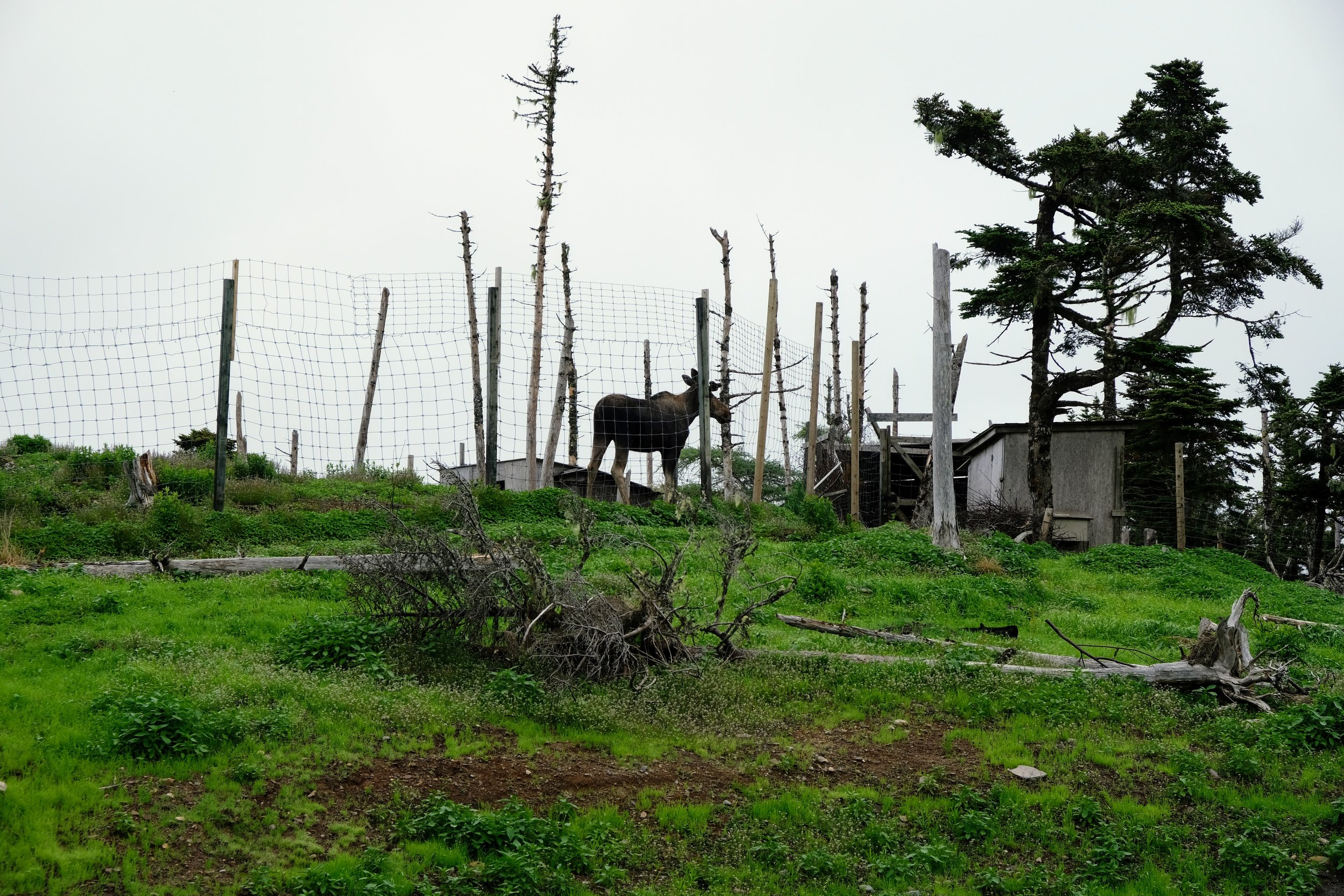
The Irish Loop is a route that follows along the southern portion of the Bonavista Peninsula from the intersection of the Trans-Canada Highway and Highway 90 all the way around to Bay Bulls on the east coast near St. John’s. My partner’s family have a cabin along here and so we went to spend a couple of days there before looping around the entire place and staying in Ferryland, about 80 kilometres south of St. John’s. While we were staying at the cabin we did a day trip to the Salmonier Nature Park which is a sort of a wild zoo for a few of the local species of wildlife. It is a massive place that you visit by walking on a huge boardwalk that loops you past a number of enclosures. The enclosures are not like you see in a city zoo, they are massive and there is a good chance that you will not see some of the animals as they will have wandered off into the woods. We did get to see a large number of them though, with my two favourites being a young moose and the woodchuck. There is a large nature centre at the beginning of the walk with information about the local animals and plants. The whole place is definitely worth spending some time in during a visit.
The reason that the Irish Loop got its name is that the southern shore, for whatever reason was the destination for many Irish immigrants in previous centuries. Due to the limited ability to travel around Newfoundland by these immigrants after they arrived, much of the culture and accent has stayed. Now I will admit I didn’t quite hear the difference in the accents, except that they were perhaps stronger than you hear in St. John’s, I was assured that they sounded quite different.
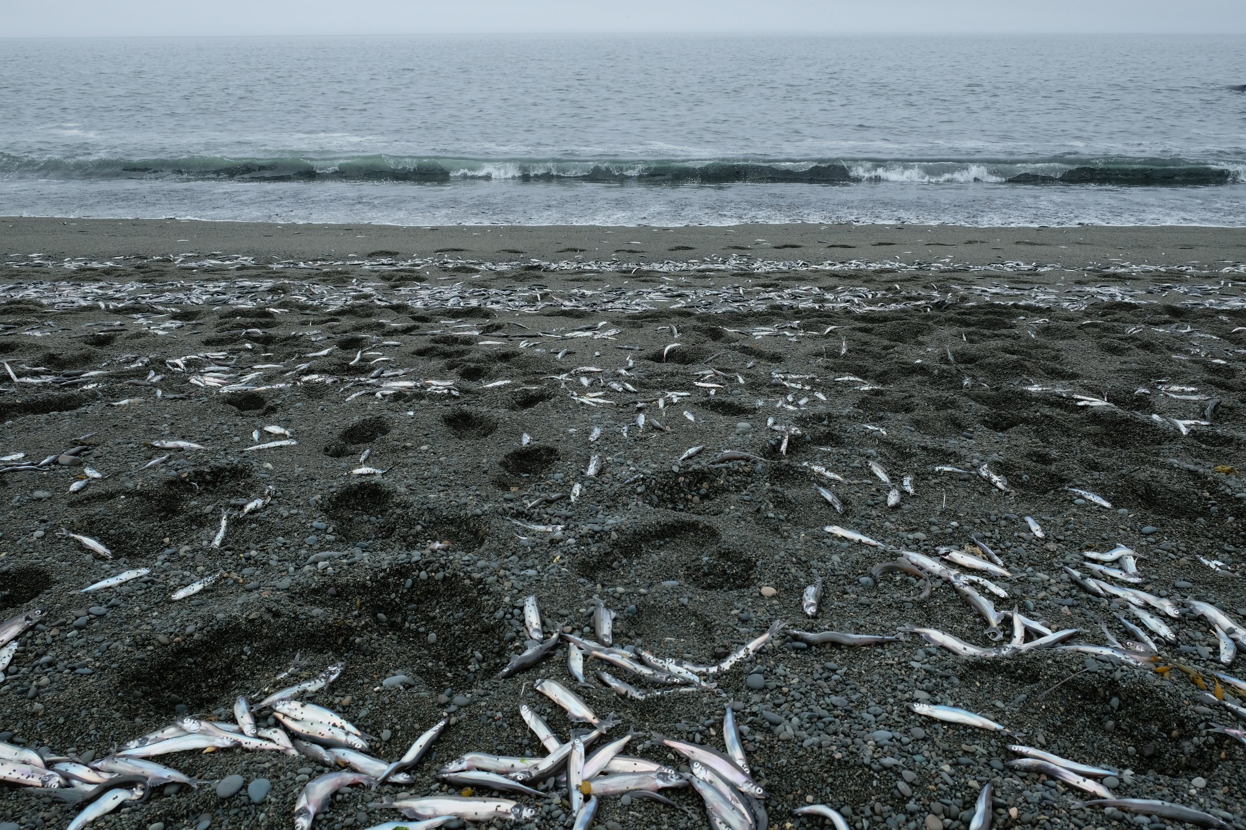
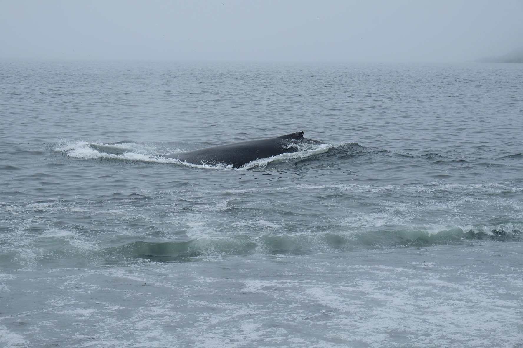
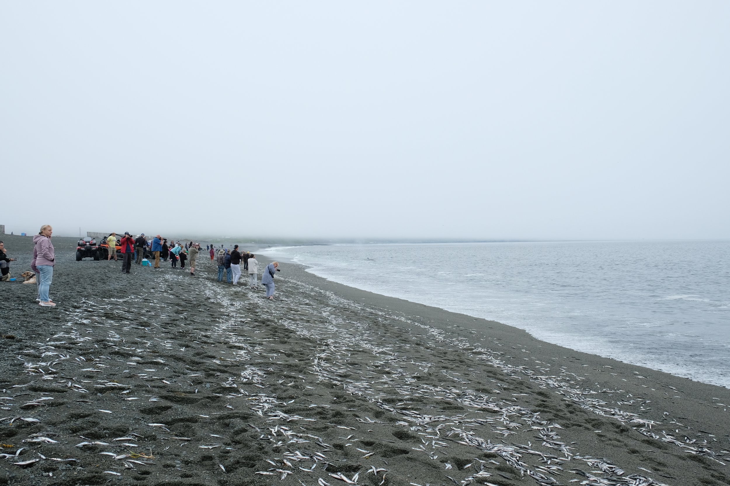
As we headed towards the southern shore, we knew that there was a chance that we could see whales at St. Vincent’s beach. When we pulled up to the parking lot the number of cars there seemed to indicate that at least something was going on, but I still wasn’t prepared for the actual scene playing out on the beach. As we moved past the wooden windbreak just past the parking lot, the whole beach stretched out a kilometre or two in each direction. There was a good crowd on the beach, maybe 150-200 people, many with massive camera lenses. Across the entire expanse of the beach and amongst the feet of all those standing on the beach were what must have been hundreds of thousands of beached capelin fish. As each wave crashed onto the beach another thousand or so were scattered, flapping back and forth, breathing their last breaths. Just past the wave breaks were maybe four or five humpback whales coasting back and forth, getting their fill of the silver feast in front of them. We had made it in time for the rolling of the capelin! It is not on the same days any year and I would suppose with climate change that it may be even less predictable. What is happening is that as the gulf stream shifts north the capelin come into the beach to lay eggs and the male fish after trying to fertilize the eggs get caught in the wave breaks. Where the schools of capelin go, the whales follow. We spent about an hour on the beach just watching the spectacle. I know it shouldn’t have, but after a while the sight of all of the dying capelin was getting to me and we headed back on the road.
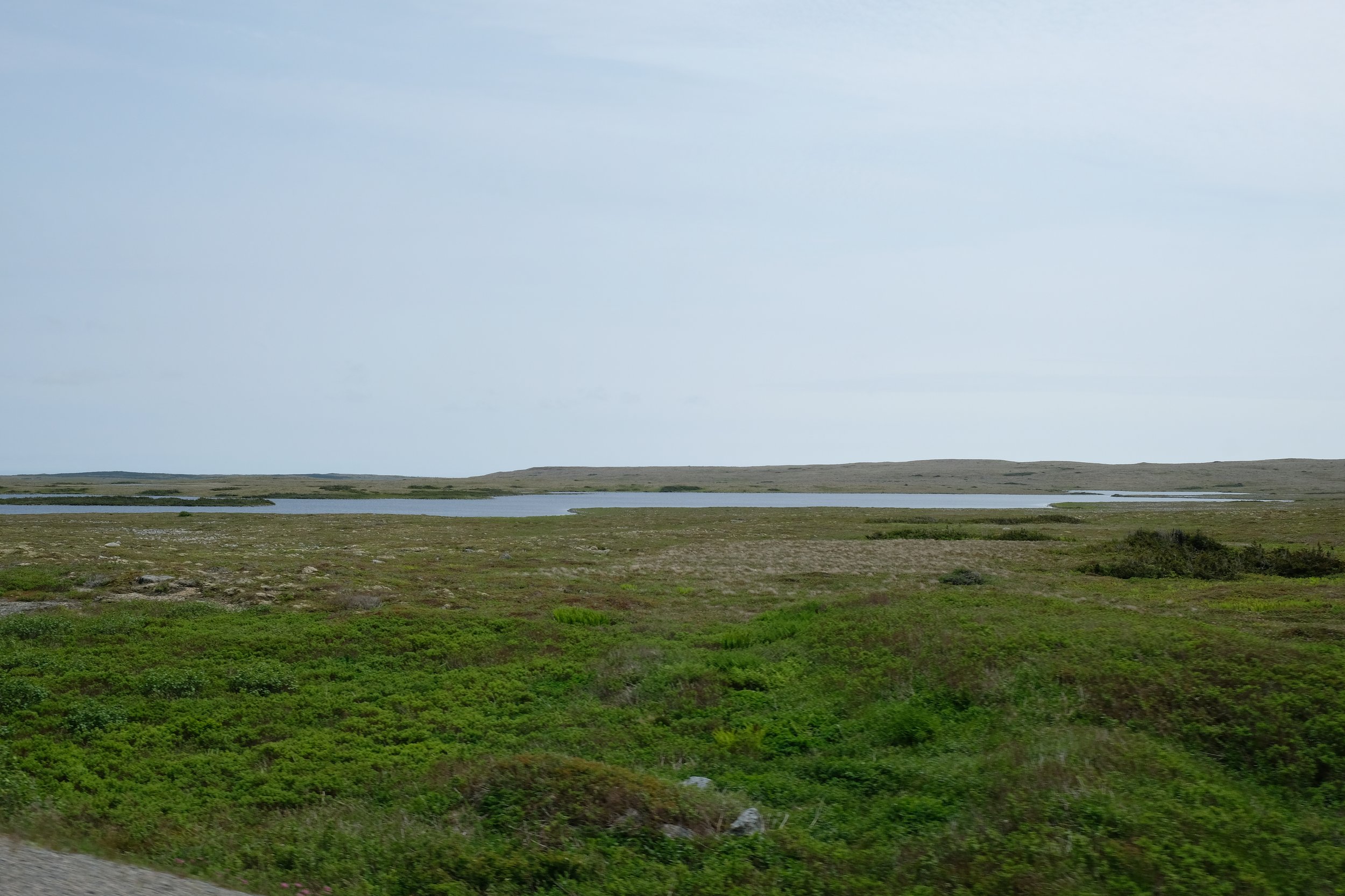
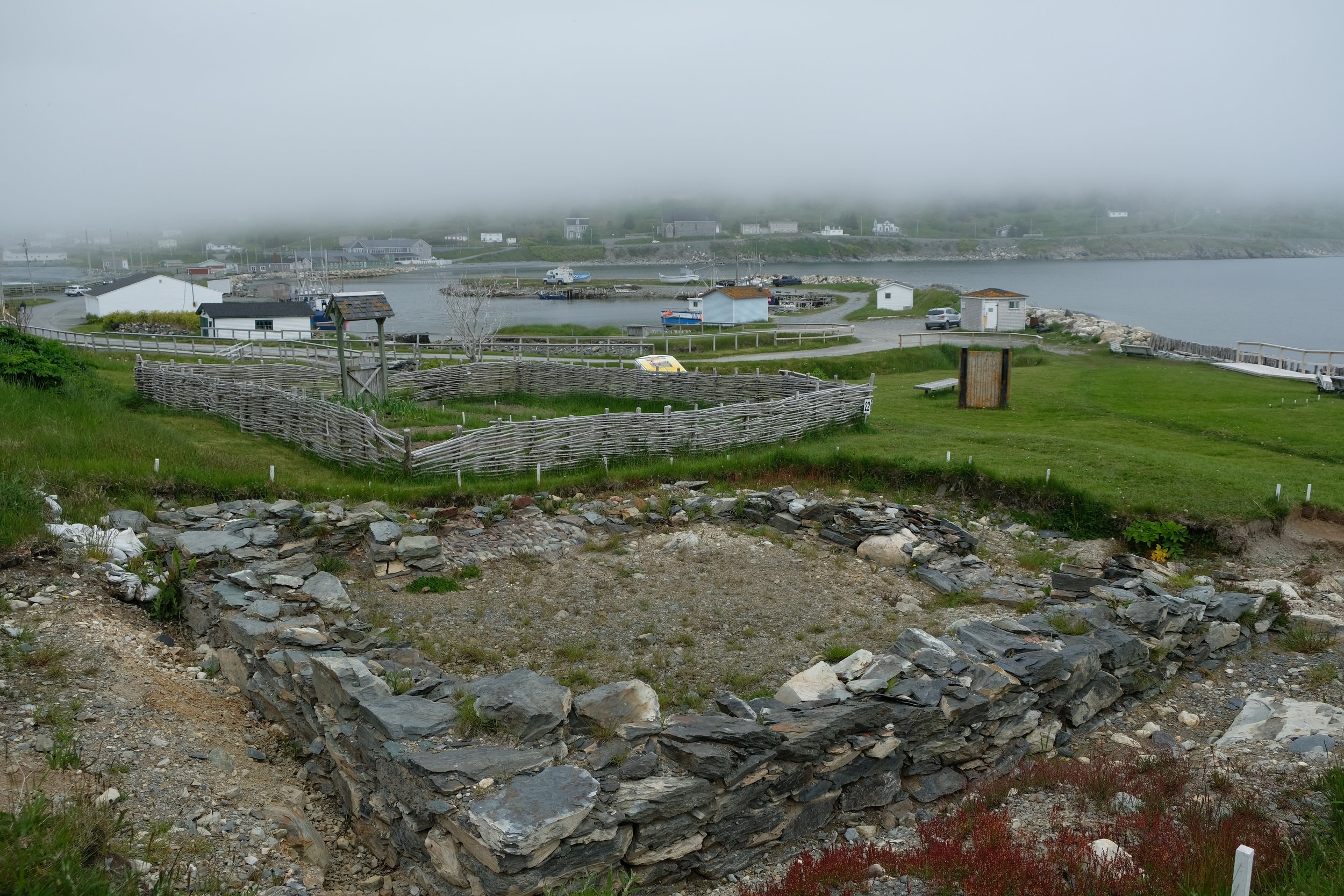
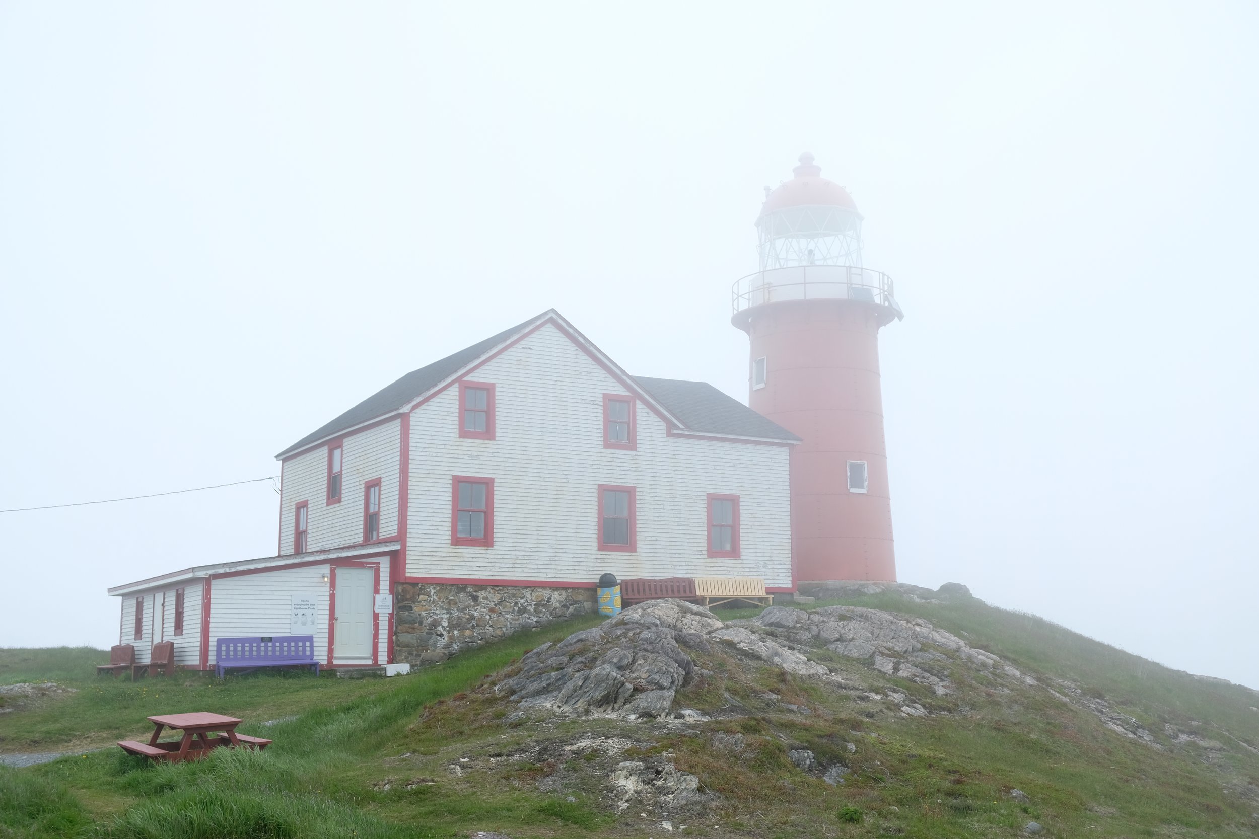
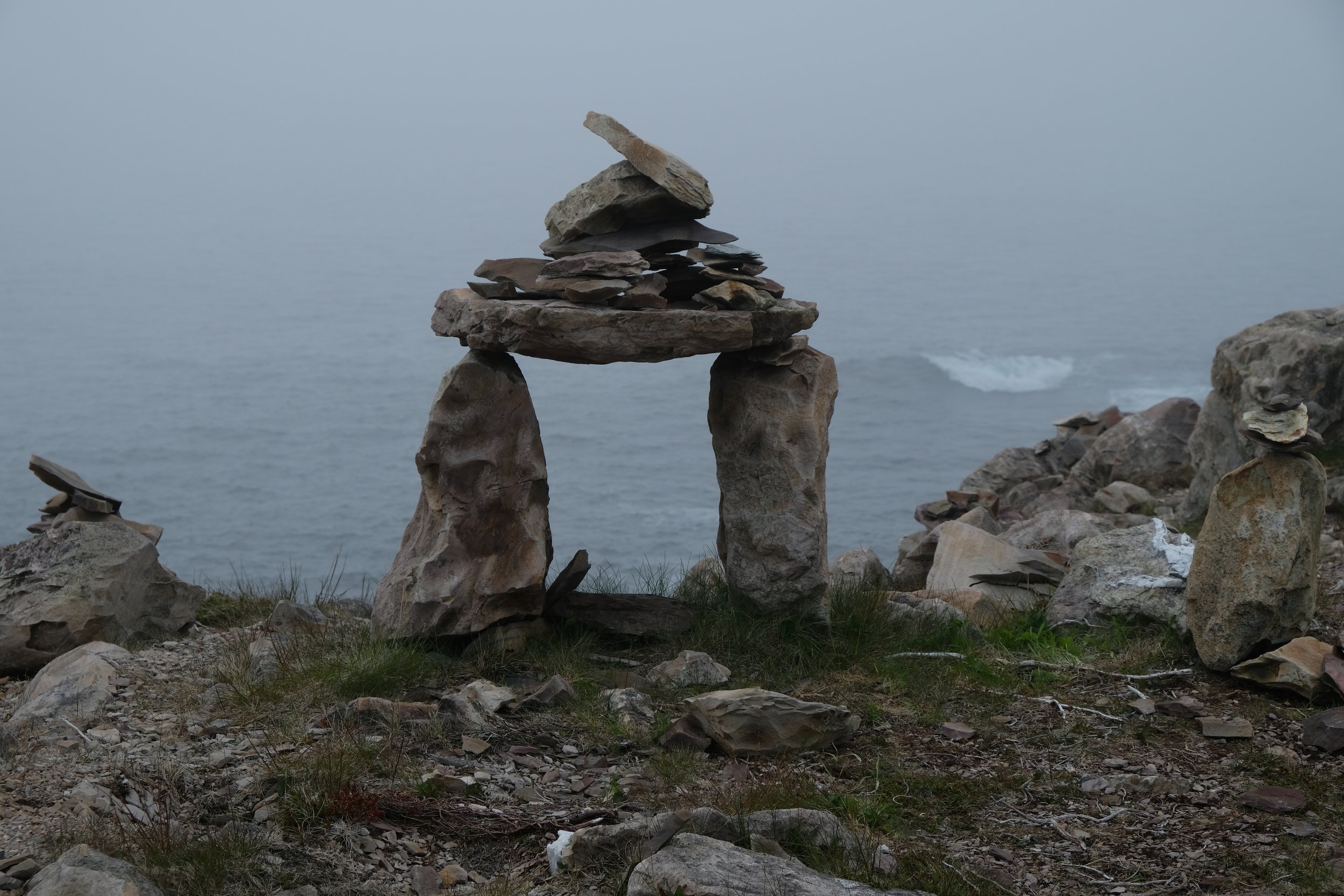
As we drove around the bottom of the peninsula there are quite a lot parts where you go inland and the landscape was quite stark, without even really a tree visible all the way to the horizon. It reminded me of some of the landscape pictures and videos I have seen of Iceland. It was an empty space, but it definitely had a raw beauty to it. In the early afternoon, we made it all the way to Ferryland where we were staying the night. The two things we had planned in Ferryland were both well worth the time there. First, was a visit to the small but fascinating Colony of Avalon archaeological site. You can see the areas that have been dug previously, as well as the current site that is being excavated and mapped. The Colony of Avalon was a small farming colony from the early 1600’s. I found it really interesting and I have to say that some of the stone work that has been uncovered is very impressive. After wandering around the archaeological site, it was time to hike out to the end of the peninsula that it sits on to see the lighthouse and have one of the famous picnics that are brought out for you. The quality of the ham in the ham and brie sandwich alone made it worth the hike out, the amazing scenery was a bonus.
I would say that the Irish Loop was maybe not quite as packed with quick things to do and see as the Bonavista peninsula, but it was so drastically different that it made a very worthwhile side trip on the way back to St. John’s. And that is where we finished up our road trip.
If you have been to any of the places on this list and I missed something important please let me know. Also I would love to hear about any other adventures on the eastern end of the island, as I am certainly going to be going back. Stay tuned for the next article on St. John’s which should be up in a couple of days. The pictures below are from the Irish Loop. Talk to you soon!