Complete Streets of Victoria - The New Fort Street

I know I am a bit behind everyone else, however, I finally had an opportunity to look at all the changes to Fort Street from Oak Bay Junction to Cook Street. I will have to take another walk along the section from the Junction to Foul Bay Road on another day. I thought I would provide a few thoughts on it and how it looks and where I think there are some challenges. To be clear, I have not biked the new section, though having biked all of the other portions of the AAA network in Victoria, I can get a pretty good grasp of it from walking next to it.
I am adding this article to my Complete Streets series which I haven’t written about in a long while. You can read about Vancouver Street here and Mason Street here. This is going to have a similar concern to those other articles. Though I want to be really clear, I think adding to our AAA bike network in Victoria is vital to the long-term viability of our urban environment and when I ride my bike, I love using the network. I live about 8 houses away from one of the AAA routes and to be able to access the system right by my house and be able to bike pretty much anywhere in the city in a safe and fast way is pretty amazing. I really am looking forward to the continuing build-out of the system across the region.

The issue that has come up for me, particularly in the City of Victoria, is that when new lanes go in, the are a substantive change to the road network. The fact that there is a huge change going occurring is not the issue, it is the thought process around the change. If we are going to significantly change a transportation route, we should be taking a complete streets approach to doing it.
So what is a “Complete Street”? The City of Victoria has its own definition which is quite good and I have referred to it in a previous article. According to the City, “Complete streets are a design approach to roadways which embrace the goal of safe and comfortable travel for all modes of transportation. They include design elements to prioritize sustainable transportation and use features that improve accessibility, contribute to well-being and placemaking, and support climate resiliency.” The key here is “safe and comfortable travel for all modes of transportation”. So if the City was using this approach when building out the cycle network, it should be ensuring that you can still travel by vehicle on those routes and that the pedestrian space is also adequate in those places. I will take this into account as I look at the changes to Fort Street, at least from the Junction to Cook Street.
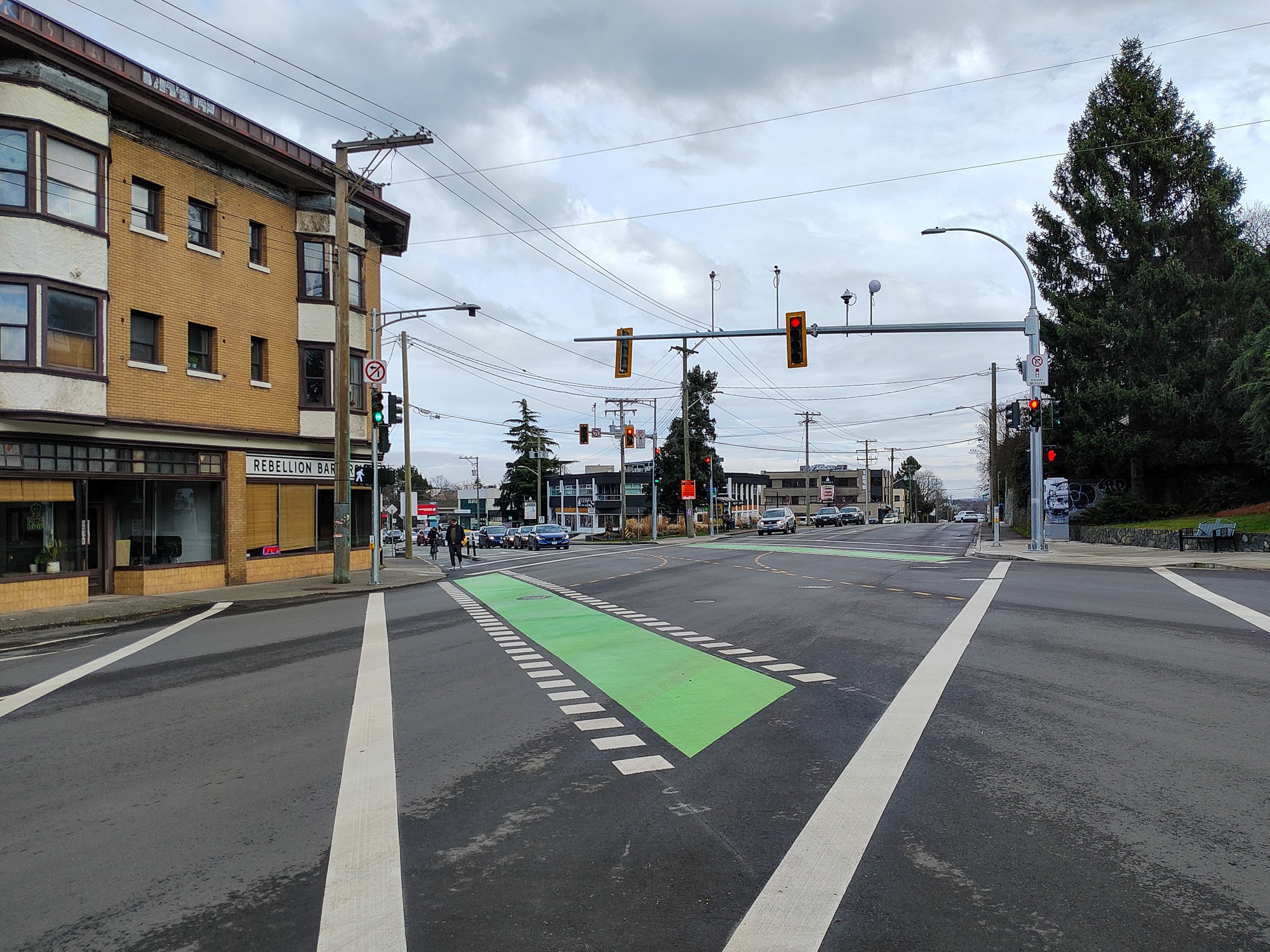
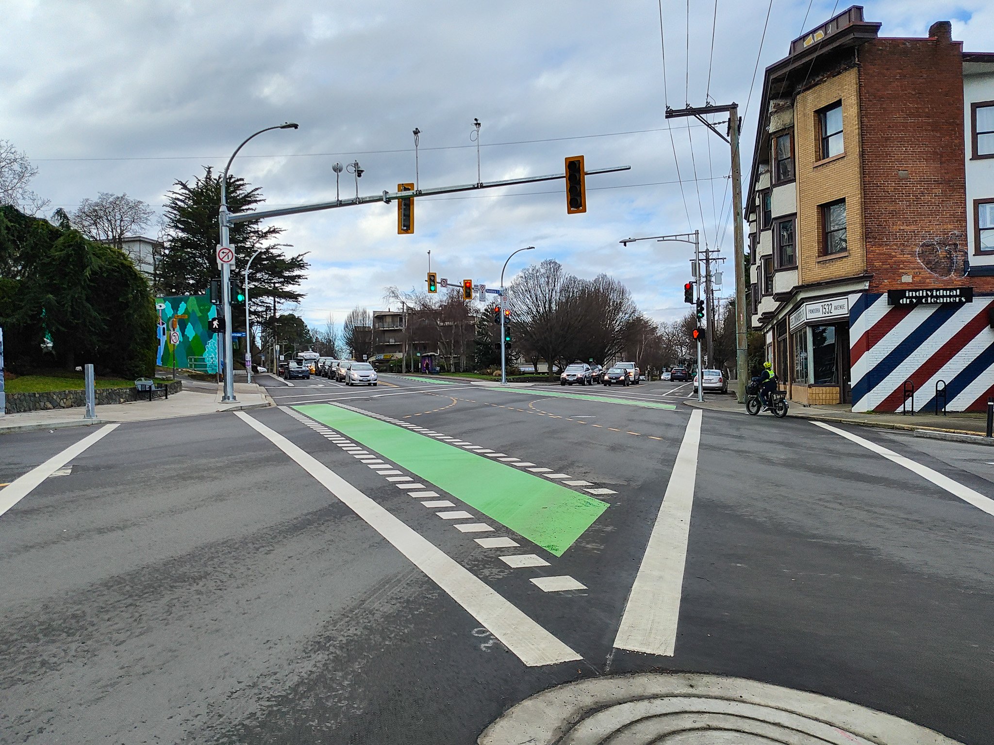
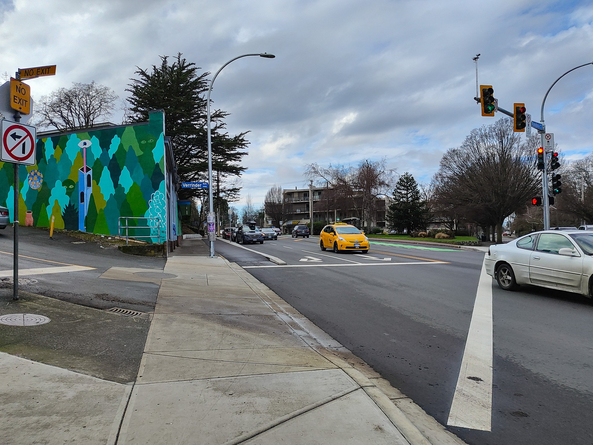
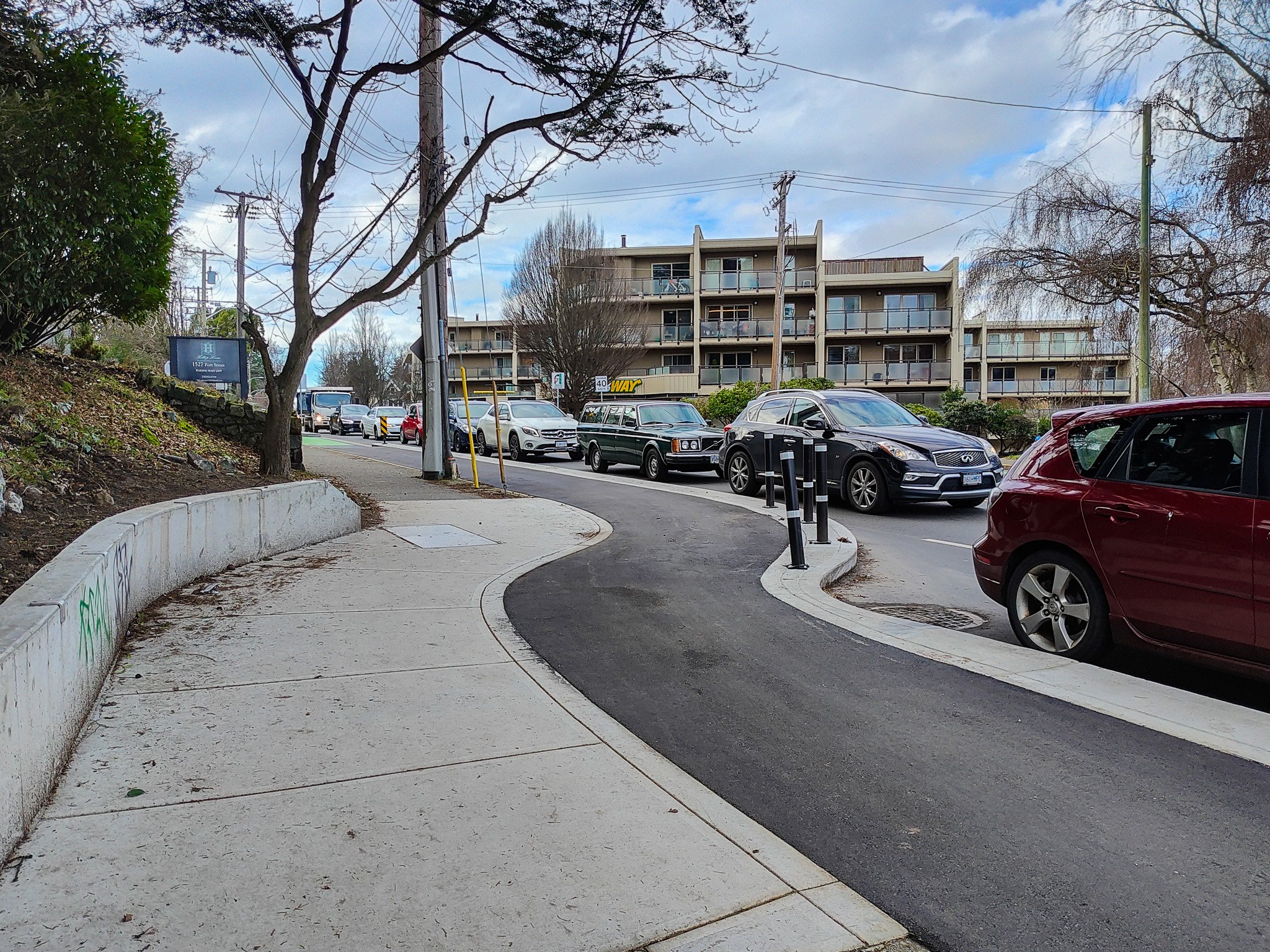

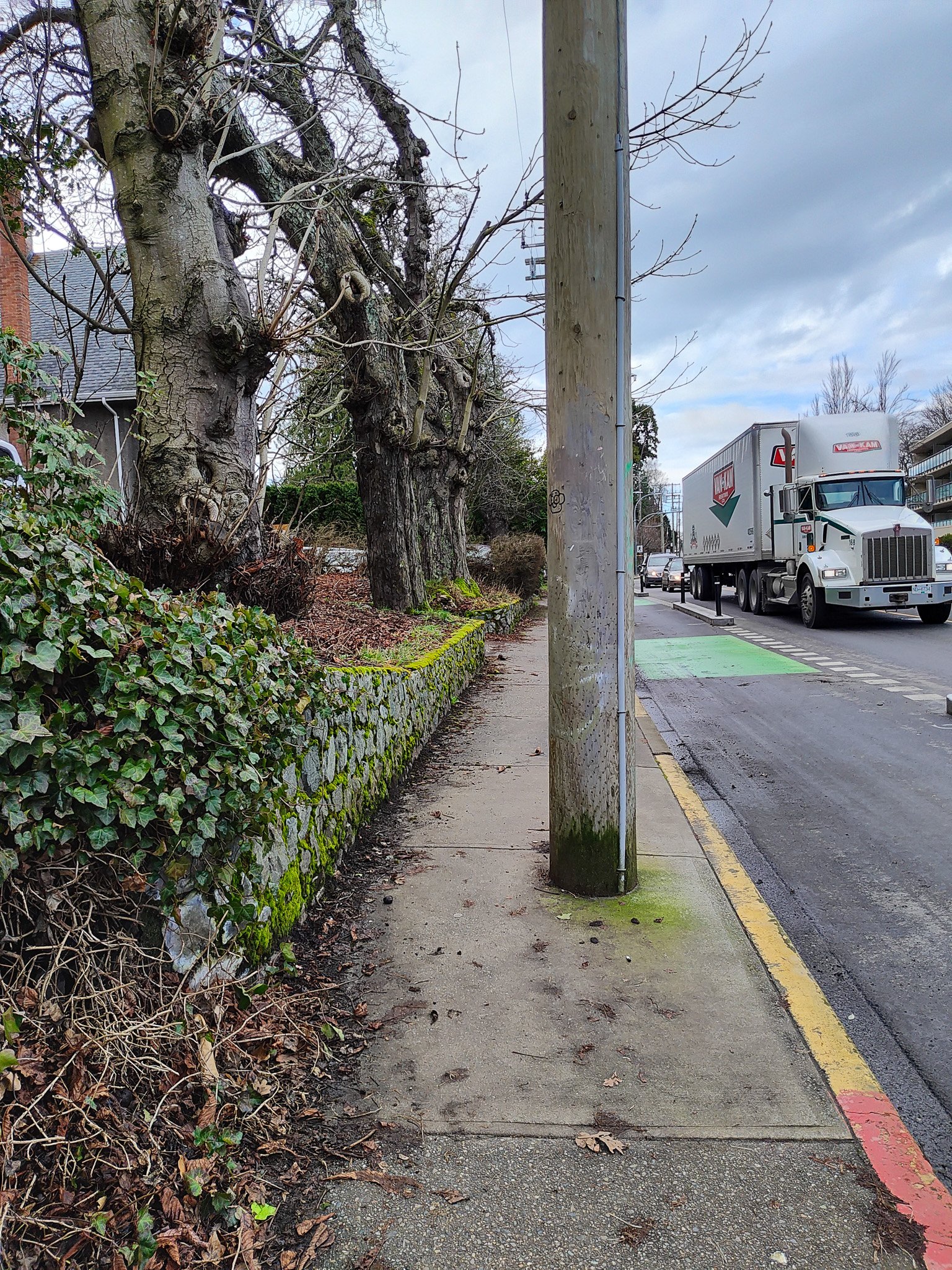
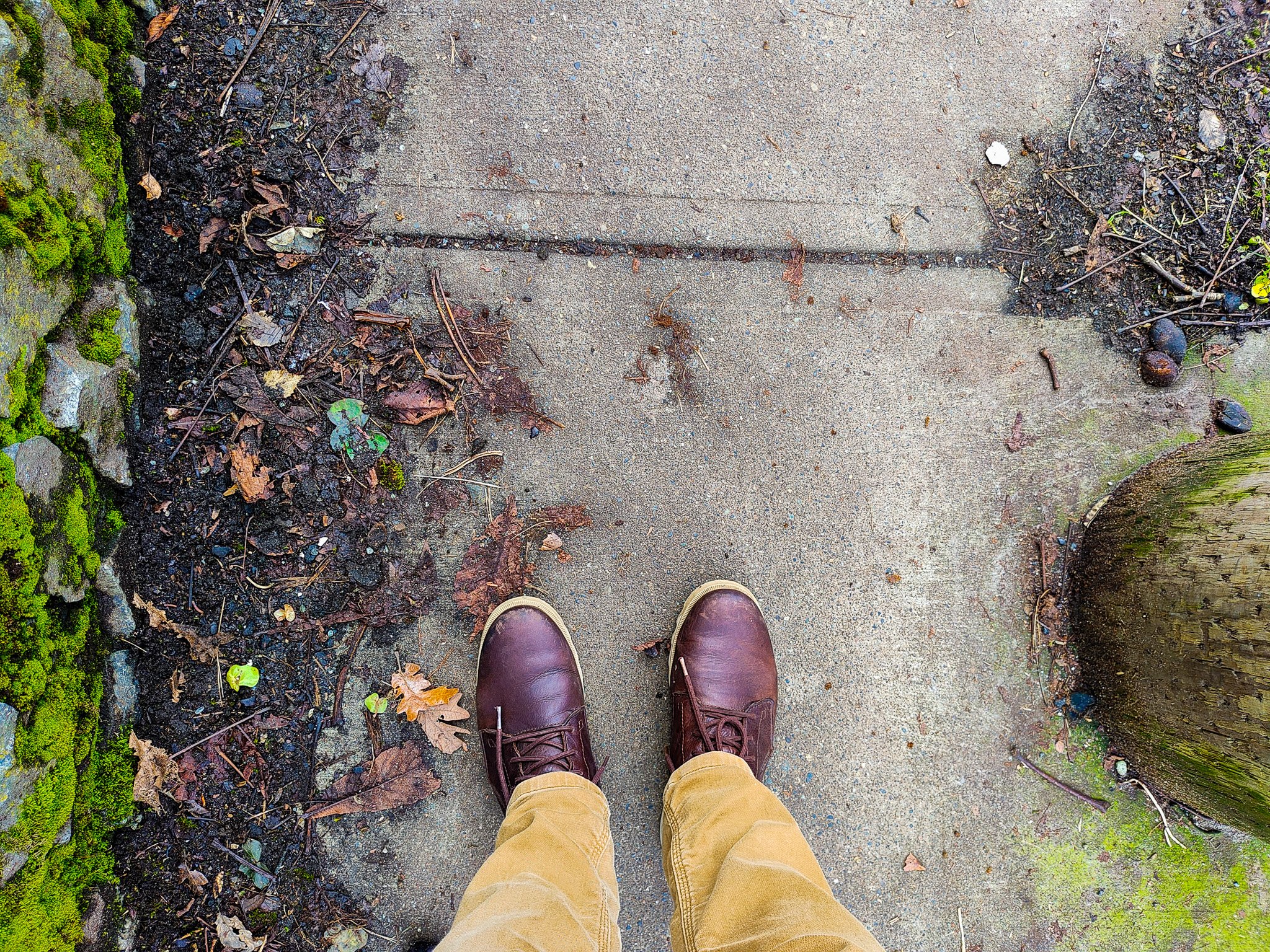
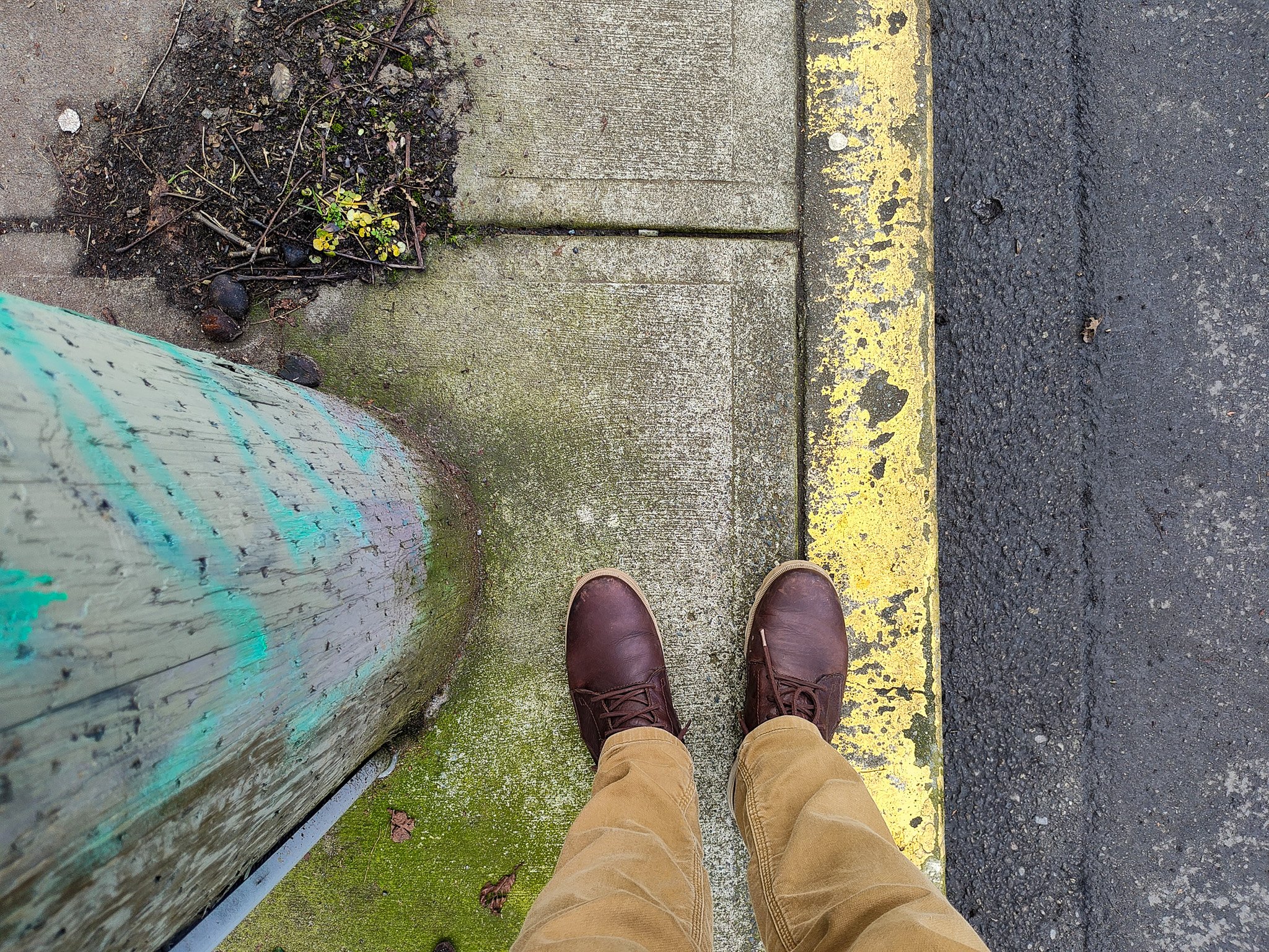
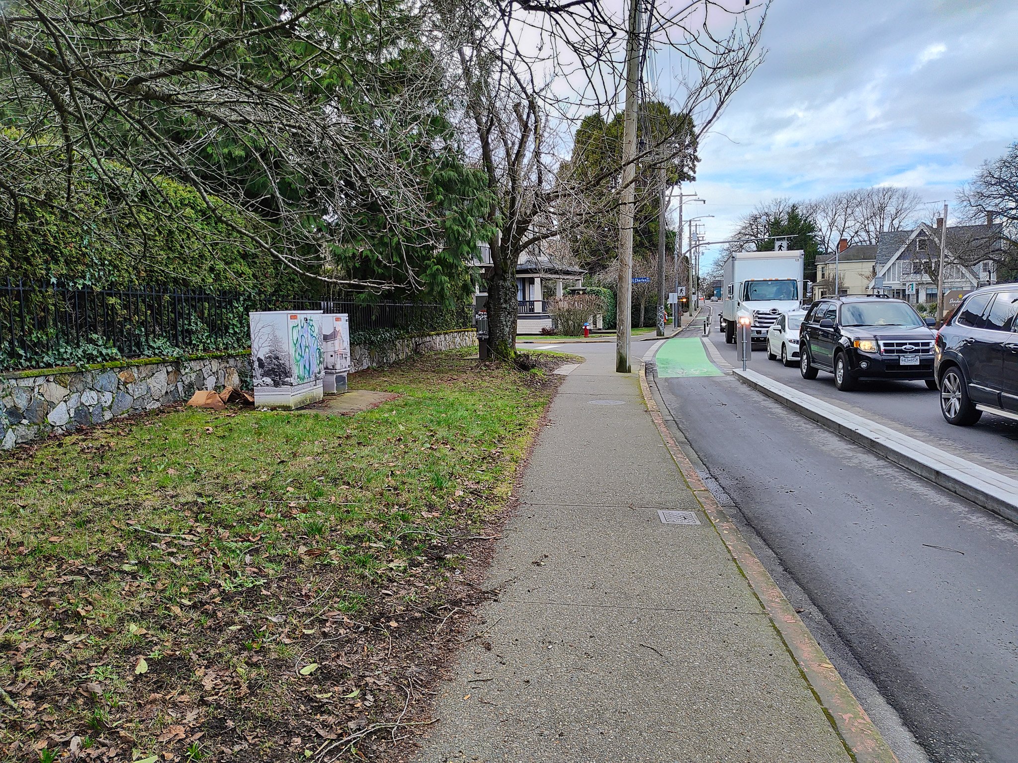
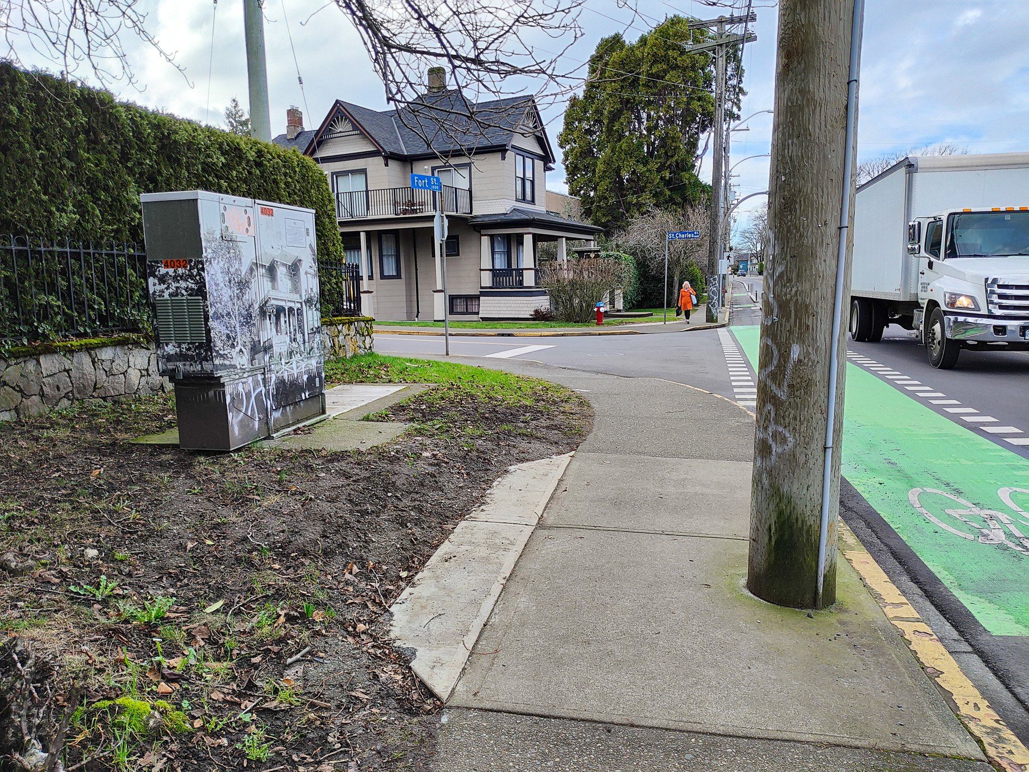
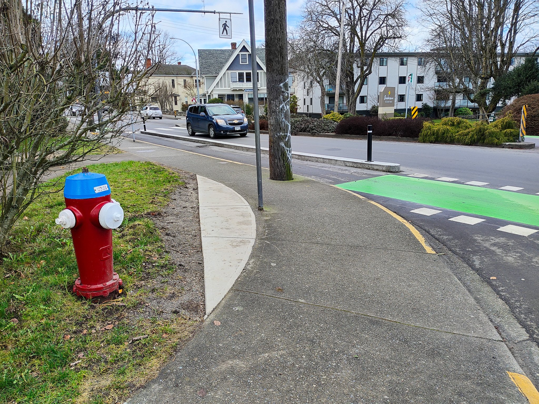
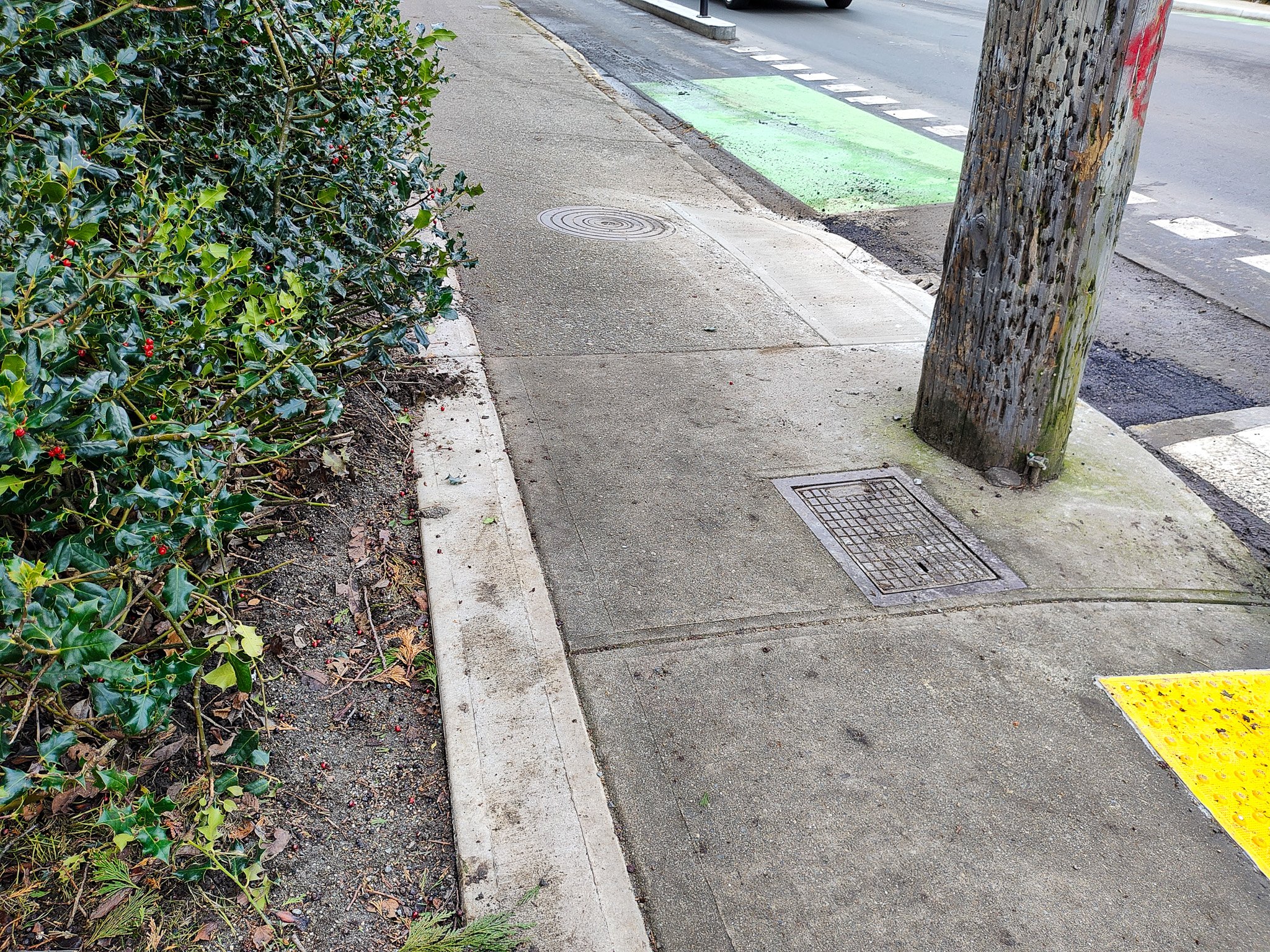
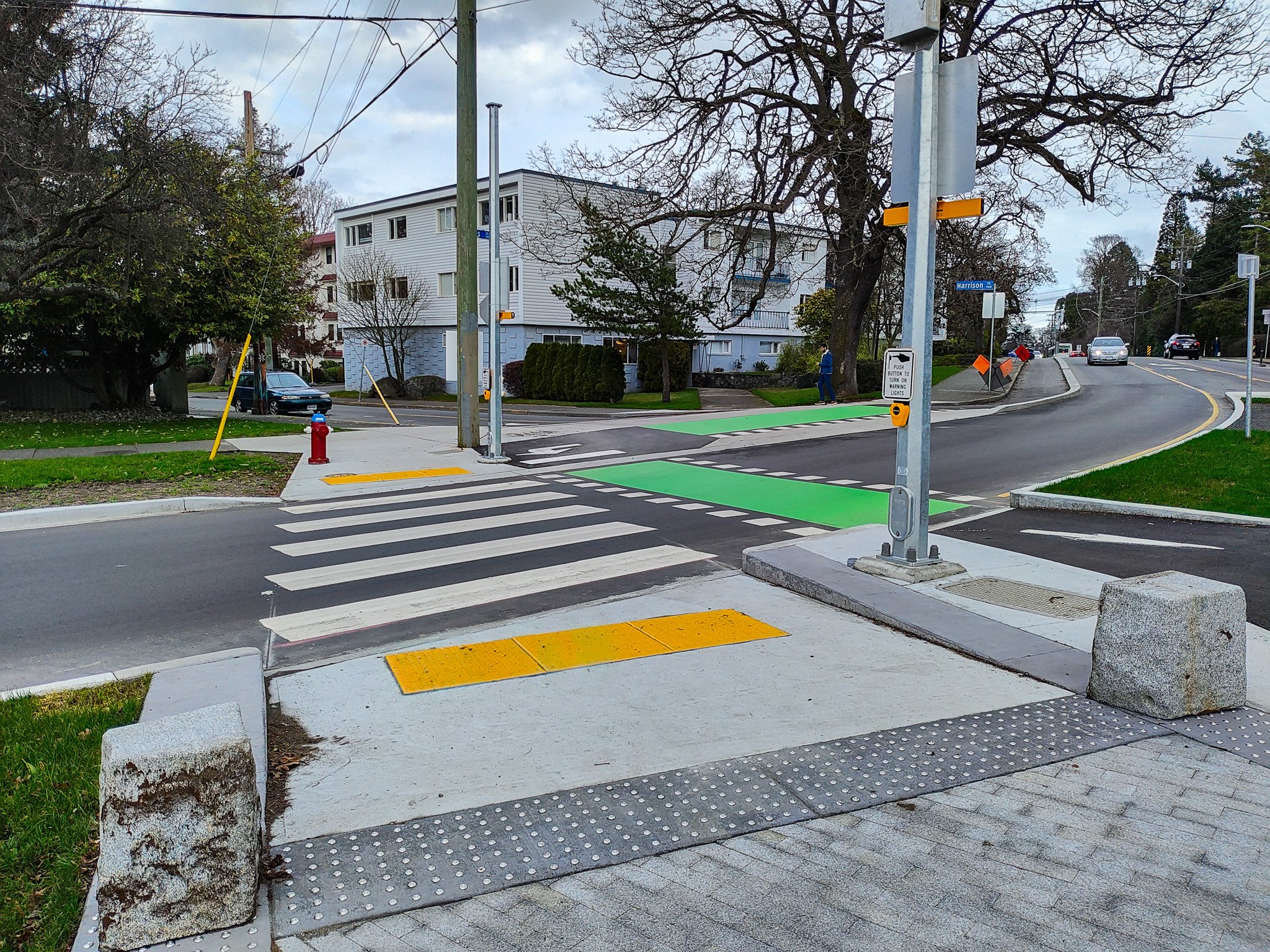
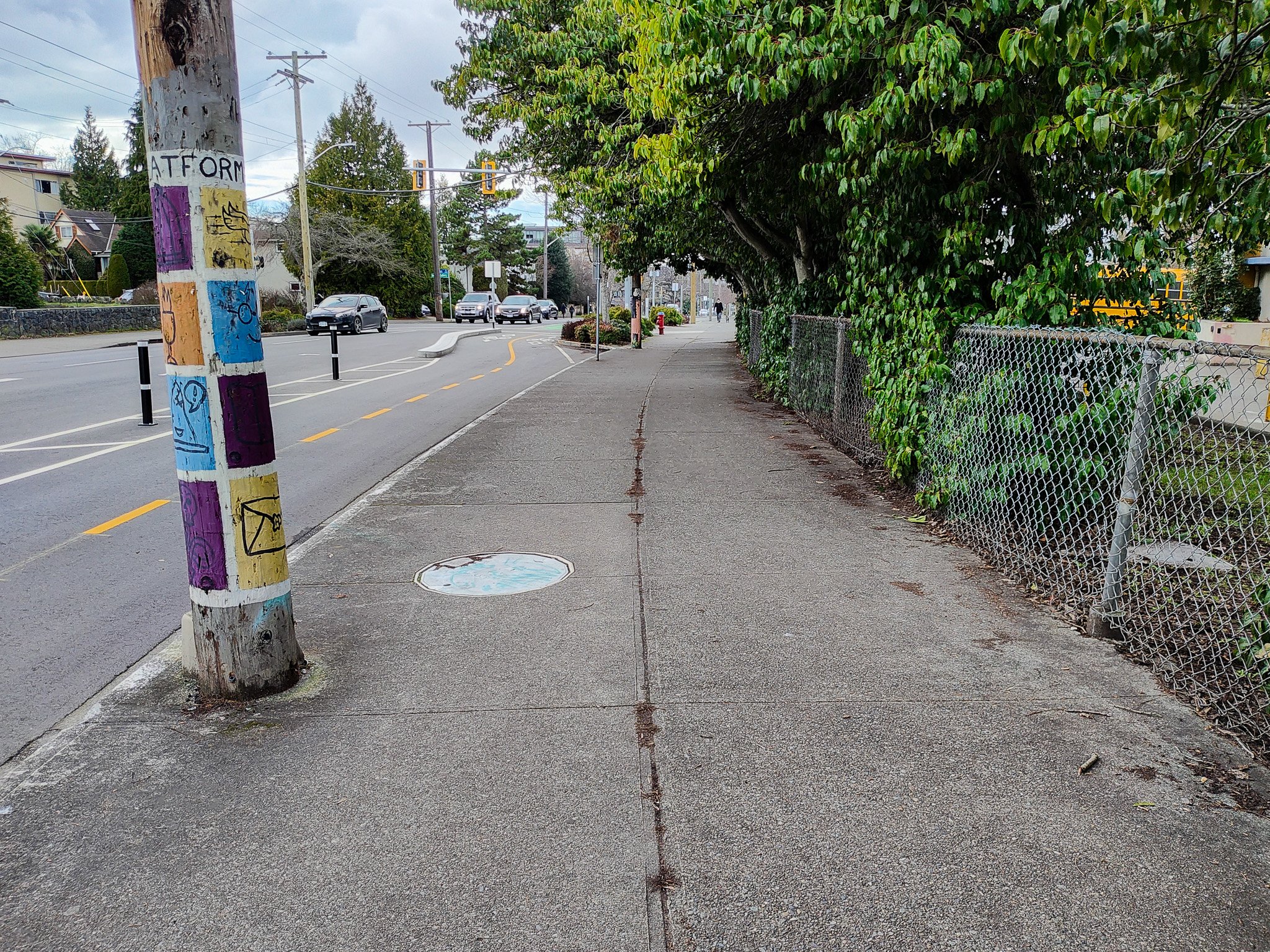
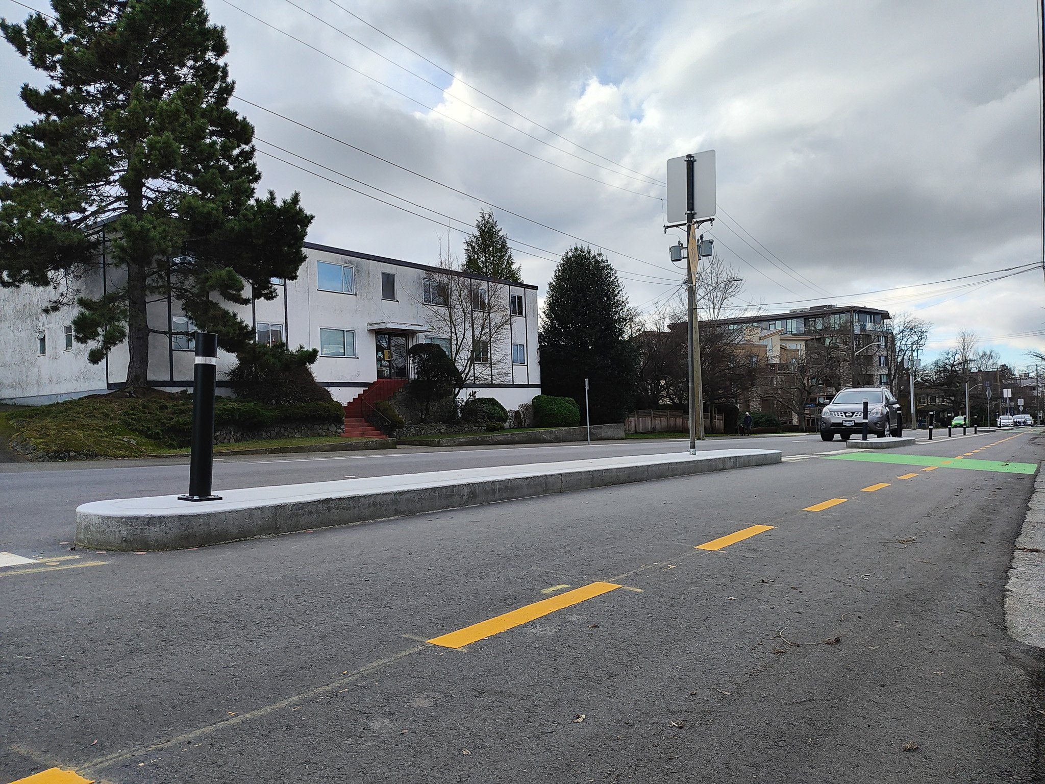
To look at the new route, I took the No. 5 bus up to the Junction and then started taking in the changes on foot from as many perspectives as I could with the plan to walk back to Cook Street. The Junction is a pretty busy intersection and it is on an odd angle which makes it a little more dangerous for all vehicles moving through it. Due to this, the addition of protected bike lanes required a lot of paint on the ground. This will need to be maintained to ensure it remains as safe as possible. After leaving the intersection I moved along the southwest corner next to Fort. This spot has some pretty challenging aspects as the space is tight and there are small roads entering from the hills to the south. One thing that seemed particularly not safe is where the bike lane crosses in front of Verrinder Avenue just west of the crosswalk. I can see why it is difficult situation for the planners. Despite the fact that there is a conflict zone right at the foot of Verrinder, there is no green paint to show that the bike lane crosses this spot. It is also a car right turn lane which is why there was likely some decision as to whether to include the paint or not. Still, it seems like a future addition that will need to be considered. Another odd part of this area is that next to Verrinder, there is a string of stores and here is the only spot where the bike lanes are raised to the same height as the sidewalk. The sidewalk here is also quite narrow for a commercial area, which means it is easy to walk out of a store and walk onto the bike lane now, creating an opportunity for conflicts. This really shows the first example along the route where a complete streets approach wasn’t used. It is pretty clear when you look at this space that planning for pedestrians wasn’t taken into account or was deemed too costly. Just to the west of this point where Belmont Avenue meets Fort at a steep angle. I understand how problematic these angles can be to change, but surely something could have been done to make the space safer for all pedestrians. There is a small traffic island that is at such a steep angle that I can only imagine how it would feel in a wheelchair or on an electric scooter. That said, the area likely doesn’t get too many people using wheeled devices because to the west of this point there is a power pole in the sidewalk that makes it so tight to pass that it might as well be a fence for some people. And what is particularly problematic about this stretch of road is that it is not as simple as just using the other side as there are no public sidewalks on the north side of Fort Street. Instead, foot traffic is required to use the private sidewalks alongside the Stadacona Centre.
When you are putting in new infrastructure like bike lanes that require a significant amount of planning and cost, there is little chance that you are going to change things again in the near future. I would be surprised if there were further changes along here in the next twenty years. Yet, the city invested millions of dollars into making a change that maintained a two block stretch that is inaccessible to those using wheelchairs along the public right of way. And yet there is a ton of space to have made it right, it just would have required the city acquiring the right of way from Stadacona Centre. This would not only have allowed for the expansion of the sidewalks along the south of Fort Street as you shifted everything a bit north, but it would actually have integrated Stadacona Centre into the city fabric more as well.
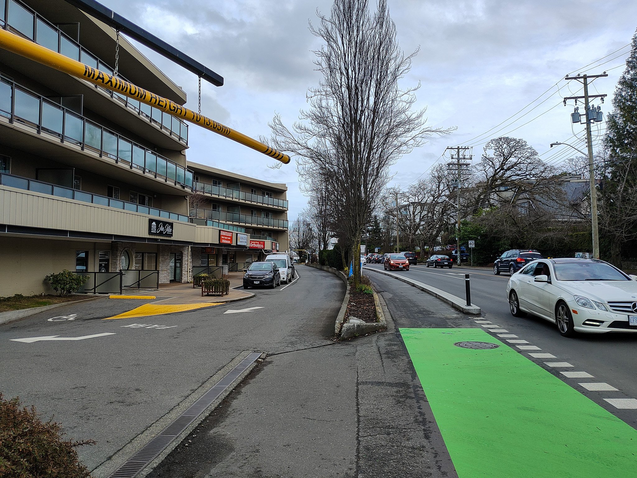
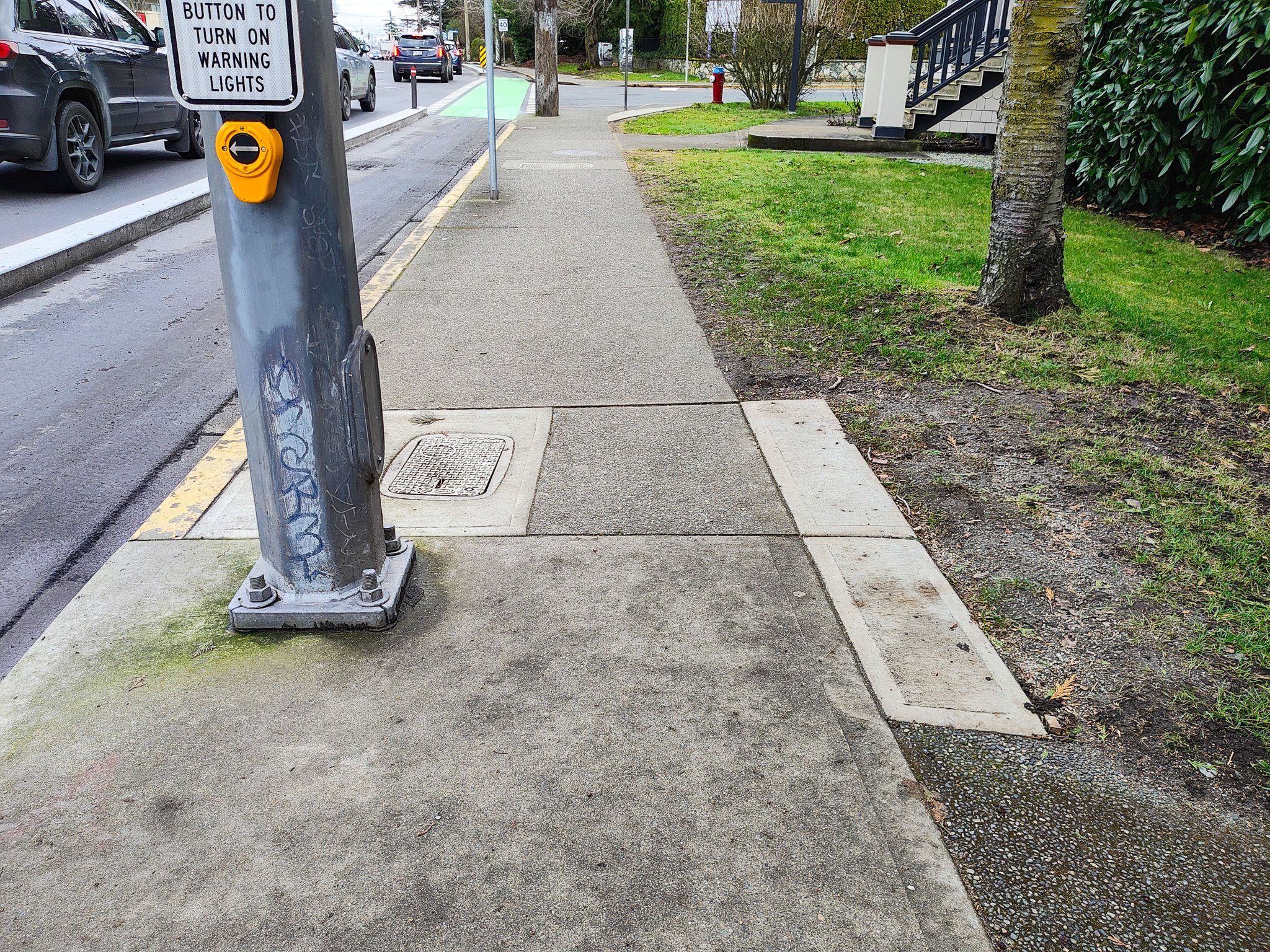
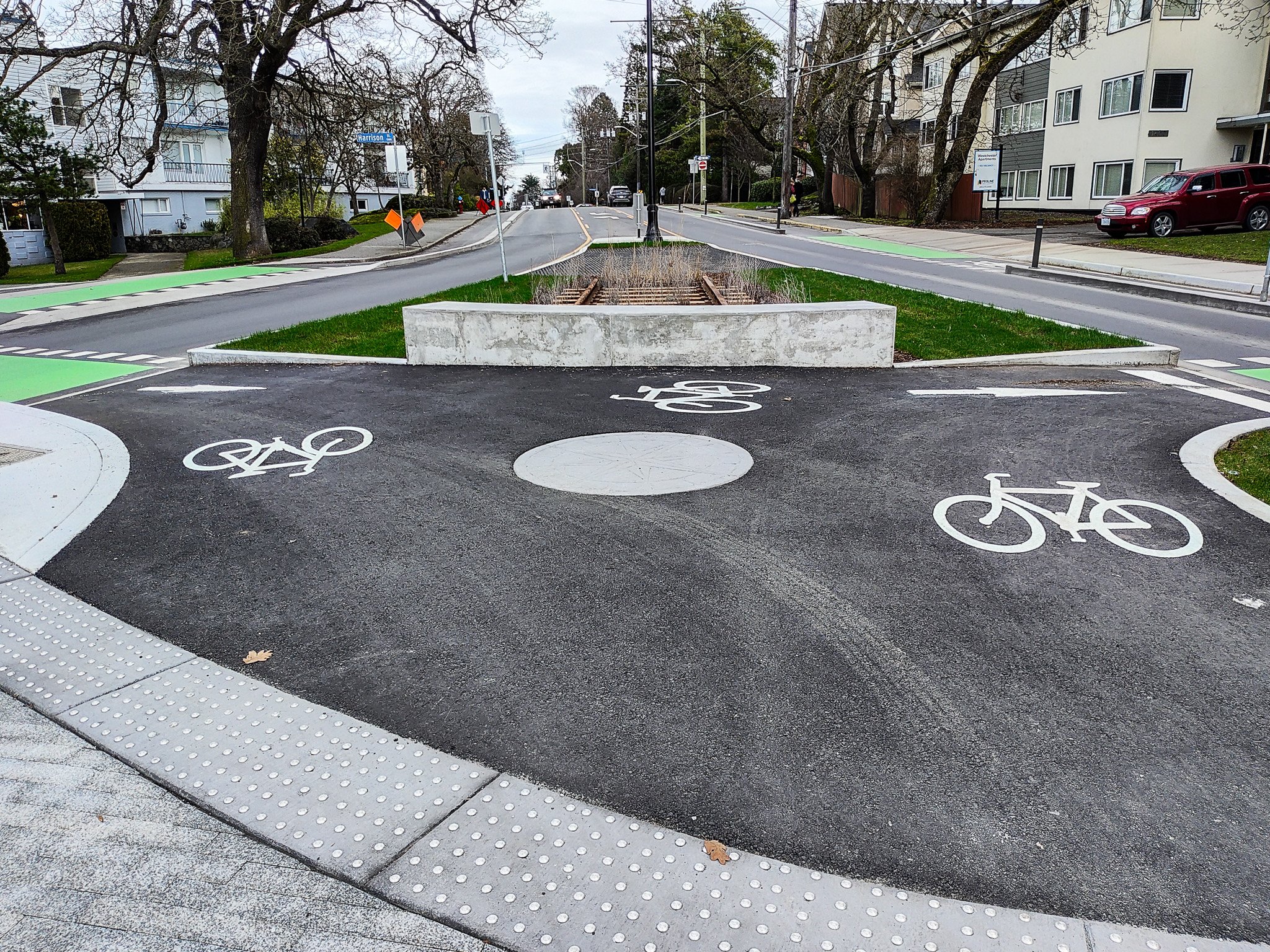
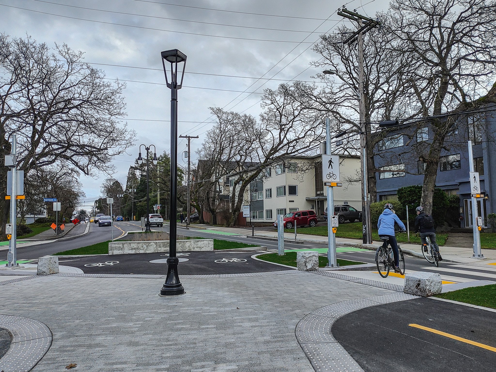
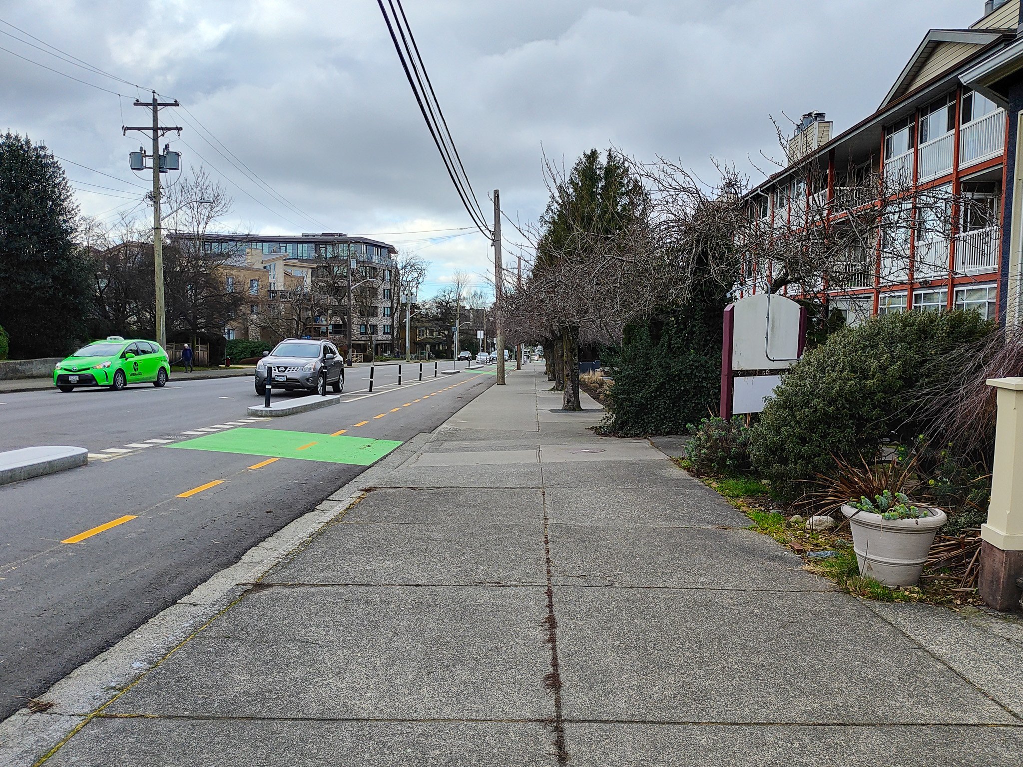
West of here things begin to improve as you see small spots where the city has increased the sidewalk spaces by little bits where they could without impacting the properties, the sidewalk is at least not obstructed for wheeled mobility. In this section, apart from the removal of a traffic lane in either direction and addition of the bike lanes, there has been little change to the street. When you get to where Yates and Fort diverge is where we see another huge change. In what is a fairly complicated set-up, Yates and Fort diverge, where at one time there was a little U-turn road to allow eastbound cars switch back to westbound, there is now a mini bike roundabout, a little pedestrian plaza, and a piece of the old streetcar rails that were unearthed near here. There are crosswalks on either side to give pedestrians the ability to switch streets and also bike path crossings so that they can get to the central island. The middle of the space has some really nice benches and you can watch all sorts of things go on around you. I will say that the little bike roundabout looks like it will be quite dangerous if we ever see any volume on this path. The only bikes that passed through when I was there, didn’t see the signals at the bike crossing and pushed the button at the crosswalk instead and rode across that to the eastbound bike lanes on fort. Still it is a very nice space and one I would definitely stop in again if I was walking by.
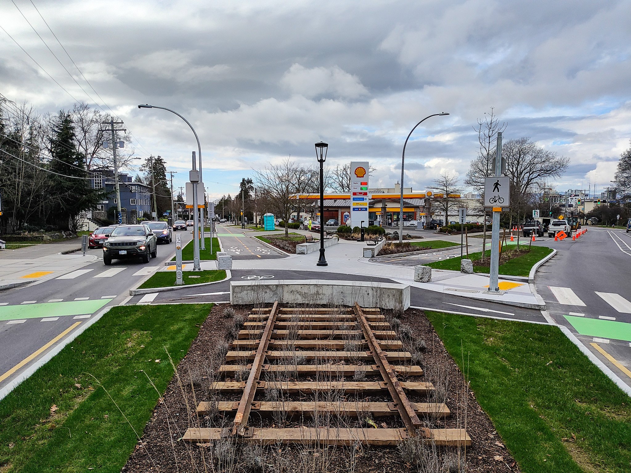
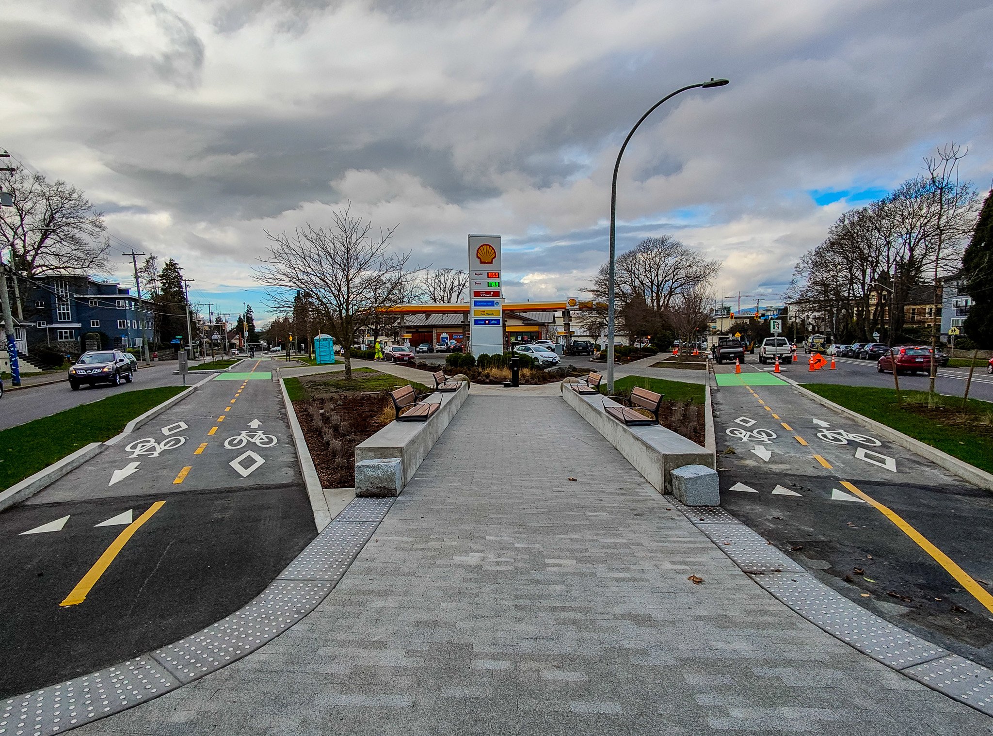
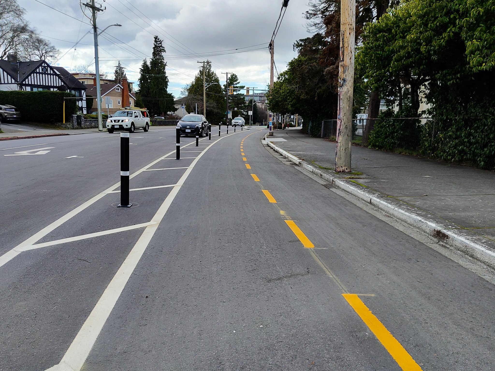
Of course, all of the infrastructure is needed at this location because we are going from one two-way street into two one-way streets. I really think that if we were actually taking a complete streets approach, we would perhaps have moved this stretch of Fort Street down to Cook back to two-way traffic. It would have allowed the continuation of the protected bike lanes on both sides of the street rather than together which I know is not generally preferred. It also would have slowed traffic down and turned Fort into a nicer street.
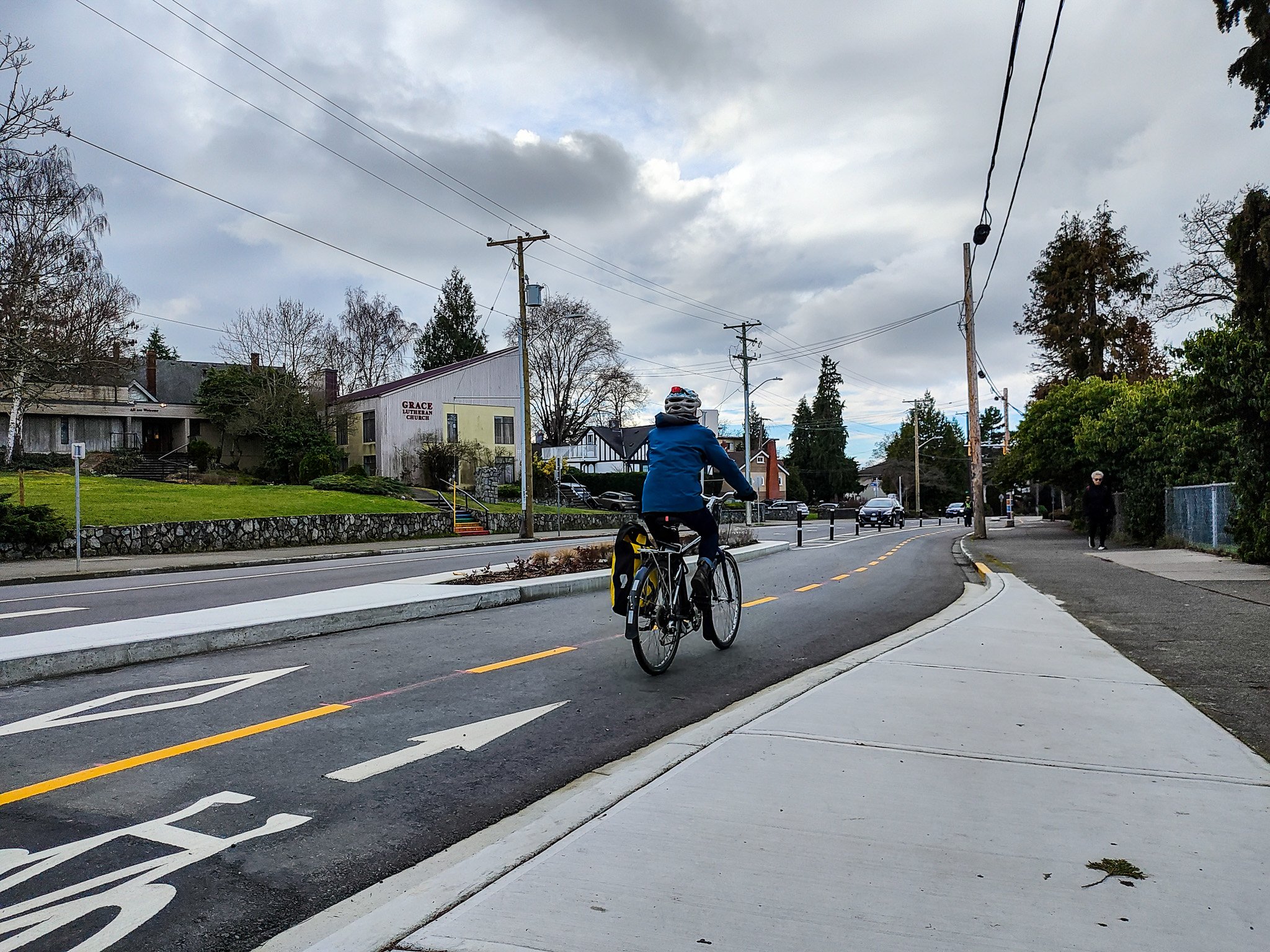
The rest of Fort Street from a complete streets approach down to Cook is quite good, though that is in large part due to the fact that previous generations of Victorians actually put good wide sidewalks along here. If any of the city planners want to know what our sidewalks should look like, a walk down Fort from Central Middle School to Douglas Street is definitely in order. On a final note, and this applies to all of the AAA bike lanes that have gone in, I wonder if the City actually asked any cyclists about where they want the bike racks put in. I say this because once again along this route I saw a few quite elaborate bike pullouts with extensive poured concrete and bike racks and none of them had any bike in them. And I say this applies to all of routes because there are numerous examples around the network. Many of them seem to be in places that are unlikely ever to need numerous bike racks in that location.
As I said at the beginning, I haven’t had the chance to ride this new stretch yet, but I will soon and when I get a chance to see the rest of Fort Street up to the Oak Bay Border, I will let you know how it is. In the meantime, if you have riddern this new part of the bike network, what do you think? How could it be improved? If you are a pedestrian using Fort Street, where could the City have made improvements? Let us know in the comments!
